The work page presents a curated selection of work that spans years of growth and exploration across art, science, technology, and design. It reflects a continually evolving journey of integrating creativity, data, and systems thinking into meaningful expressions. Central to this body of work is a profound appreciation of beauty — not as mere ornamentation, but as a quality capable of revealing connections, fostering understanding, and inspiring greater care for the world and one another.
Please note: More work samples are being added regularly as Molly continues cataloging and archiving her past and current projects.
From Observation to Regeneration: An Introduction to Landscape Ecology, Ecological Land Management, and Regenerative Food Systems
digital design programs
2026
From Observation to Regeneration: An Introduction to Landscape Ecology, Ecological Land Management, and Regenerative Food Systems (2026) is my contribution for a workshop developed for the International Union of Superiors General (UISG) and the Union of Superiors General (USG) in Rome. The presentation introduces the fundamentals of landscape ecology and regenerative land management through the lens of Catholic Social Teaching, demonstrating how ecological observation, spatial analysis, and systems thinking can guide the stewardship of Church lands. Combining original cartography, ecological design principles, case studies, and theological reflection, the workshop equips religious communities to understand landscapes as interconnected systems and to make land-use decisions that strengthen biodiversity, food security, climate resilience, and the common good. The work reflects my broader practice of integrating geospatial science, ecological design, and Catholic theology to support regenerative stewardship at institutional and global scales.
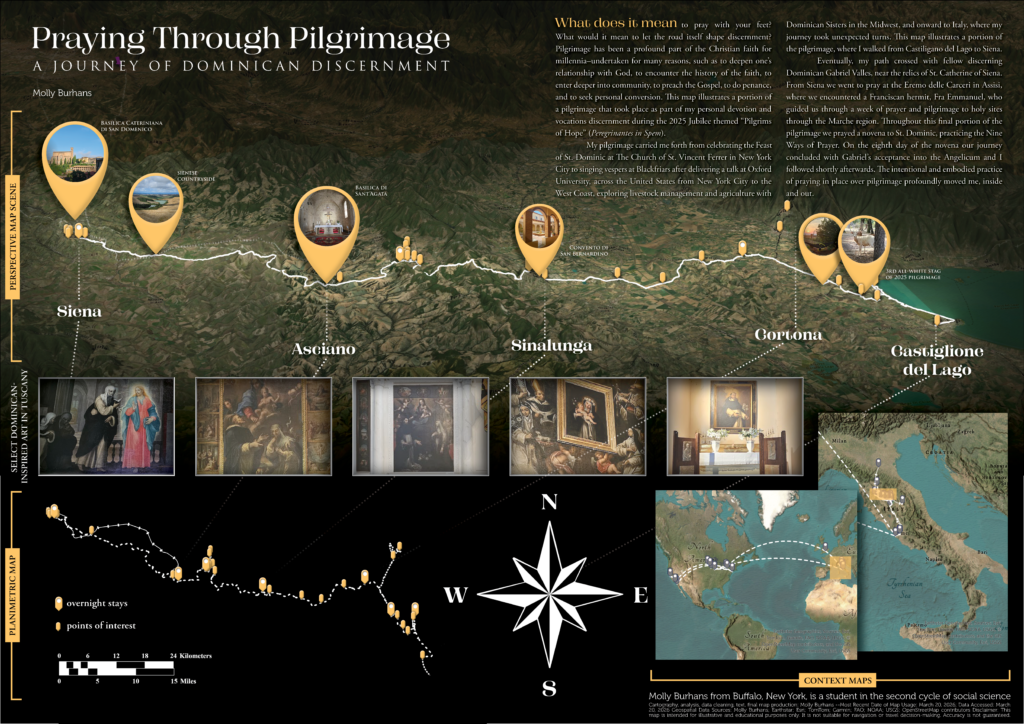
Praying Through Pilgrimage: A Journey of Dominican Discernment
Digital Design Tools and Esri GIS
2026
A cartographic narrative of a 2025 pilgrimage from Castiglione del Lago to Siena, integrating mapping, photography, and reflection to explore pilgrimage as embodied, place-based spiritual practice.
“Martyr of the Amazon”
Digital design tools, Adobe, Autodesk, ESRI, Blender, Microsoft VS and Office
2026
Harvard Government School Lecture 2018: Metagovernance of Transnational Non-State Actors: The Catholic Church — A Global Approach Working Across Scales
digital design programs
2018
Graphic showing “Metagovernance of Transnational Non-State Actors: The Catholic Church — A Global Approach Working Across Scales” shows how the Catholic Church functions as one of the largest and oldest transnational non-state actors in the world. Drawing on my work in ecclesiastical geography and geospatial analysis, I created this framework for understanding the Church’s unique governance structures and influence across geopolitical, ecological, and social systems. The talk emphasized the importance of multi-scale approaches to metagovernance– spanning parish to global levels — and offered insights into how the Church’s vast infrastructure and networks could be leveraged for addressing humanitarian, environmental, and policy challenges.
Global Diocesan Biodiversity Measures
ESRI suite, Adobe suite, AWS
2019
This video demo features an interactive map application that visualizes biodiversity avian, amphibian, and mammalian species richness within each Catholic dioceses worldwide.
“Can The Catholic Church Solve the Climate Crisis?” — TEDxBoston 2022 Visuals
Digital design tools, Adobe, Autodesk, ESRI, Blender, Microsoft VS and Office
2022
Sowing Hope for Children in our Care
software development, data mining, ESRI tools, Adobe, various digital design programs
2018 – 2019
Sowing Hope for Children in Our Care was an initiative led by the International Union of Superiors General, GoodLands, and the GHR Foundation, to help women religious better understand and respond to the needs of children outside of family care. Grounded in Catholic values of family, community, and compassion, the project aimed to illuminate and strengthen the Church’s long-standing commitment to vulnerable children worldwide. GoodLands mined and mapped nearly 50 years of Vatican data from the Annuarium Statisticum Ecclesiae, creating the first global digital geo-dataset of Catholic childcare, healthcare, and women religious globally from 1980 onward. The team developed custom software integrating machine learning to clean, structure, and analyze the data, leading the project’s data architecture, design, and storytelling.
Catholics Orphanages 1980 – 2016
ESRI suite, Adobe suite
2019
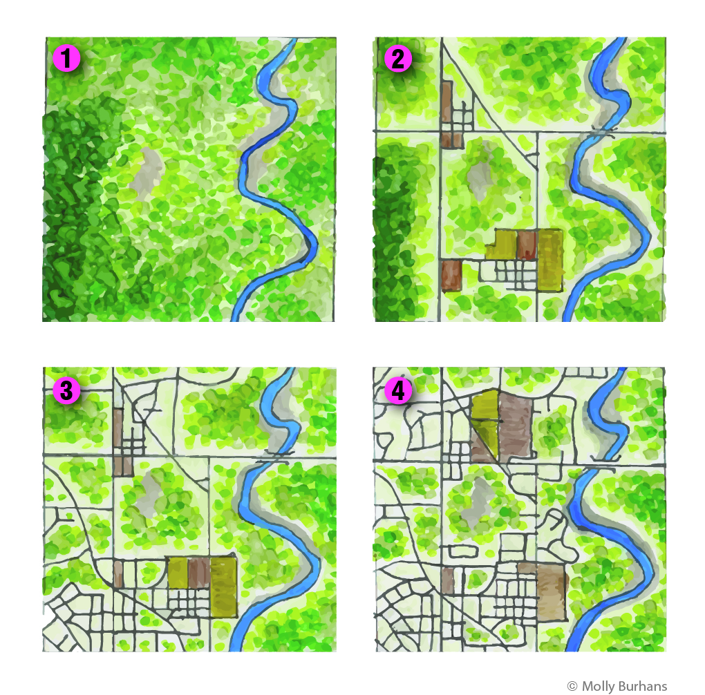
Habitat Fragmentation
marker, pen, Adobe suite
2015
This diagram illustrates four quadrants showing varying degrees of habitat fragmentation, from landscapes with large core habitats to highly fragmented areas with isolated patches. It highlights how fragmentation reduces habitat size and connectivity while increasing edge effects, which can disrupt species movement and weaken ecosystem stability. [Inspired by the work of landscape ecologist Richard T.T. Forman]
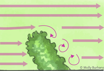
Windflow Over Hedgerows: Overhead
marker, pen, Adobe suite
2015
[Inspired by the diagrammatic style and work of landscape ecologist Richard T.T. Forman]
“High horns, low horns, silence, and finally a pandemonium of trumpets, rattles, croaks, and cries that almost shakes the bog with its nearness … A new day has begun on the crane marsh. A sense of time lies thick and heavy on such a place … Our ability to perceive quality in nature begins, as in art, with the pretty. It expands through successive stages of the beautiful to values as yet uncaptured by language.”
— Aldo Leopold
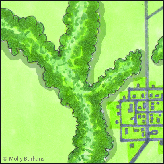
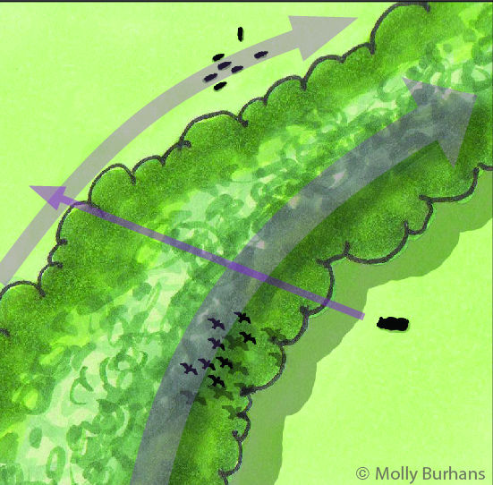
Habitat Corridors
marker, pen, Adobe suite
2015
A habitat corridor is a linear landscape element that differs from its surroundings and connects two or more otherwise isolated patches, facilitating the movement of species, energy, and ecological processes across a fragmented landscape. [Inspired by the work of landscape ecologist Richard T.T. Forman]
Habitat Corridor Function
marker, pen, Adobe suite
2015
These corridors help sustain biodiversity — they enable species movement between isolated habitat patches, promoting genetic diversity, supporting seasonal migration, and increasing ecosystem resilience by linking critical habitats within a broader matrix. [Inspired by the work of landscape ecologist Richard T.T. Forman]
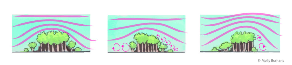
Windflow Over Hedgerows: Sections
marker, pen, Adobe suite
2015
hedgerows influence airflow across agricultural landscapes, creating sheltered zones and reducing wind speed. The Venturi effect, where wind accelerates through narrow gaps, can occur between closely spaced hedgerows, affecting microclimates and soil stability. Proper hedgerow spacing and design can optimize these dynamics for ecological and agricultural benefits. [Inspired by the work of landscape ecologist Richard T.T. Forman]
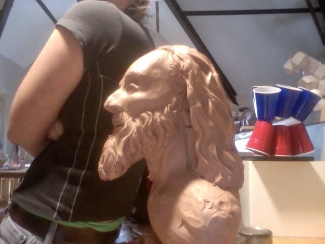
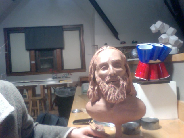
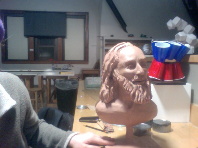
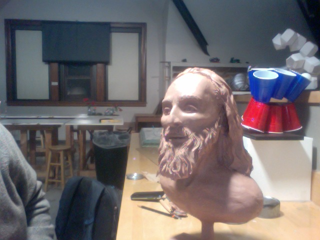
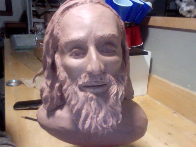
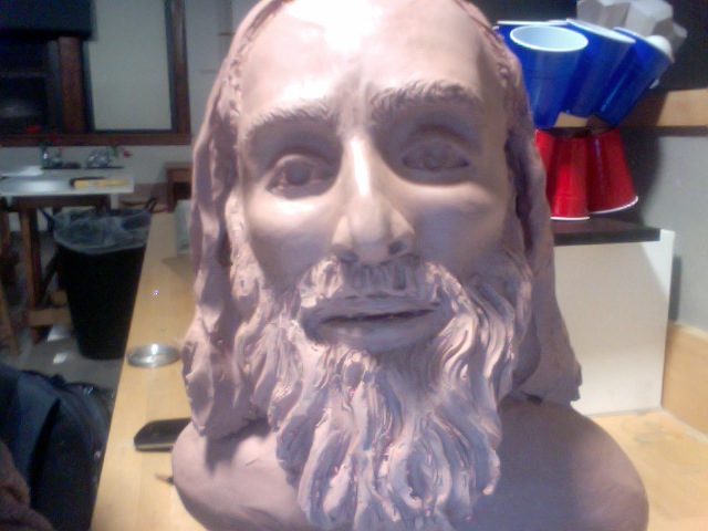
Meditation on the Face of Christ
clay
2013
This project emerged as an artistic meditation on the face of Christ, shaped by my journey through St. Ignatius’ Spiritual Exercises. These contemplations, deeply visual in nature, invited a quiet dialog between creature, creation, and Creator. With hands in clay and heart in prayer the form unfolded intuitively.
Catholics around the World
ESRI suite
2018
This video demo showcases an interactive, globe-spanning map application developed by Molly Burhans. It visualizes the size and distribution of Catholic populations globally, using geospatial data layers to represent diocesan boundaries and population densities. By animating or adjusting map zoom levels, viewers can see how Catholic communities vary in scale, region by region. The visualization highlights both densely Catholic areas and regions where the Church is smaller, offering a compelling tool for understanding the Church’s global presence and demographic distribution.
Tree Cover Loss by Diocese: 2005 – 2017
ESRI, Open Street Map
2018
This video is a demo of an interactive map application developed by Molly Burhans for GoodLands. It visualizes global tree cover loss from 2005 to 2017, organized by Catholic diocesan boundaries. The map integrates data from Global Forest Watch, GoodLands’ geospatial database of Catholic dioceses, and Catholic hierarchy data to show where and how forest cover has changed across Church jurisdictions, leadership, and people worldwide. The tool highlights a potential for faith-based environmental action by aligning ecological data with ecclesiastical geography.
“Later that night
I held an atlas in my lap
ran my fingers across the whole world
and whispered
where does it hurt?
It answered
everywhere
everywhere
everywhere.”
— Warsan Shire
Catholics Deadly Heatwaves
ESRI, Adobe
2017
This video demo presents an interactive map application created by Molly Burhans that visualizes the ages of Catholic bishops across dioceses. The map highlights dioceses in yellow where the current bishop is above the typical retirement age of 75, providing a clear, visual overview of leadership transitions within the Church. Designed as part of GoodLands’ suite of ecclesiastical planning tools, the application blends demographic data with geographic context to support strategic leadership planning and ecclesial governance.
Use the arrow(s) on the cover edge and pages or swipe to flip through the pages of the flipbook embedded above.
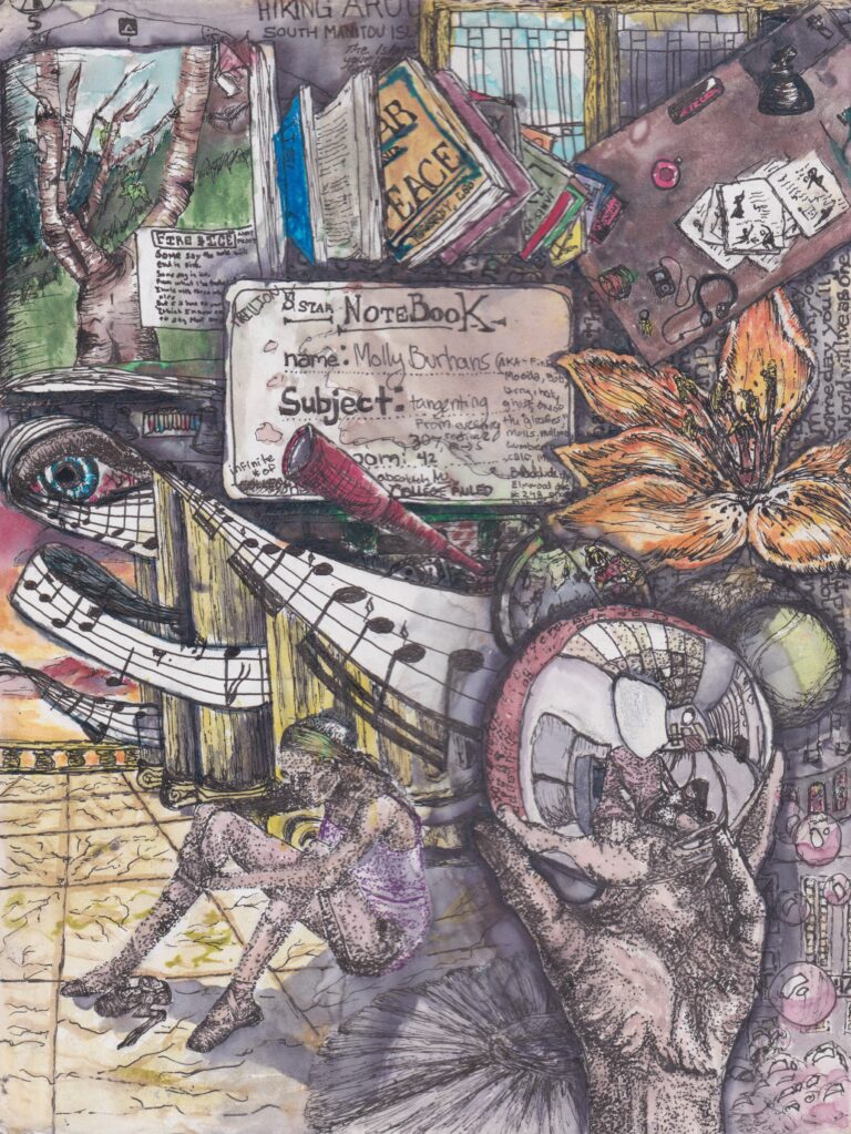
Selected Notes on Biology
pen, ink, copic marker, colored pencil, water color
2009 – 2011
This is a collection of nearly 60 selected pages from some of the most colorful volumes of my studies in science. I regularly peruse independent scientific and mathematical studies; sometimes I read/work through textbooks and articles, I occasionally sit in on classes and lectures, and I worked in a molecular and cellular biology lab at a local cancer research center seasonally for a number of years. How tacit understanding and rigorously logical analysis co-operate within the scientific method is a point of interest to me; as are philosopher Michael Polyani’s writings on this. Combining science, math and art allows me to grasp the application of ideas and visualize terminology and equations in a unique way. Including visual creation into the learning process can be an incredibly rewarding experience. I believe that nature, and our understanding of it, is immeasurably valuable — for the sake of its profound beauty and the potential applications of that knowledge for good.
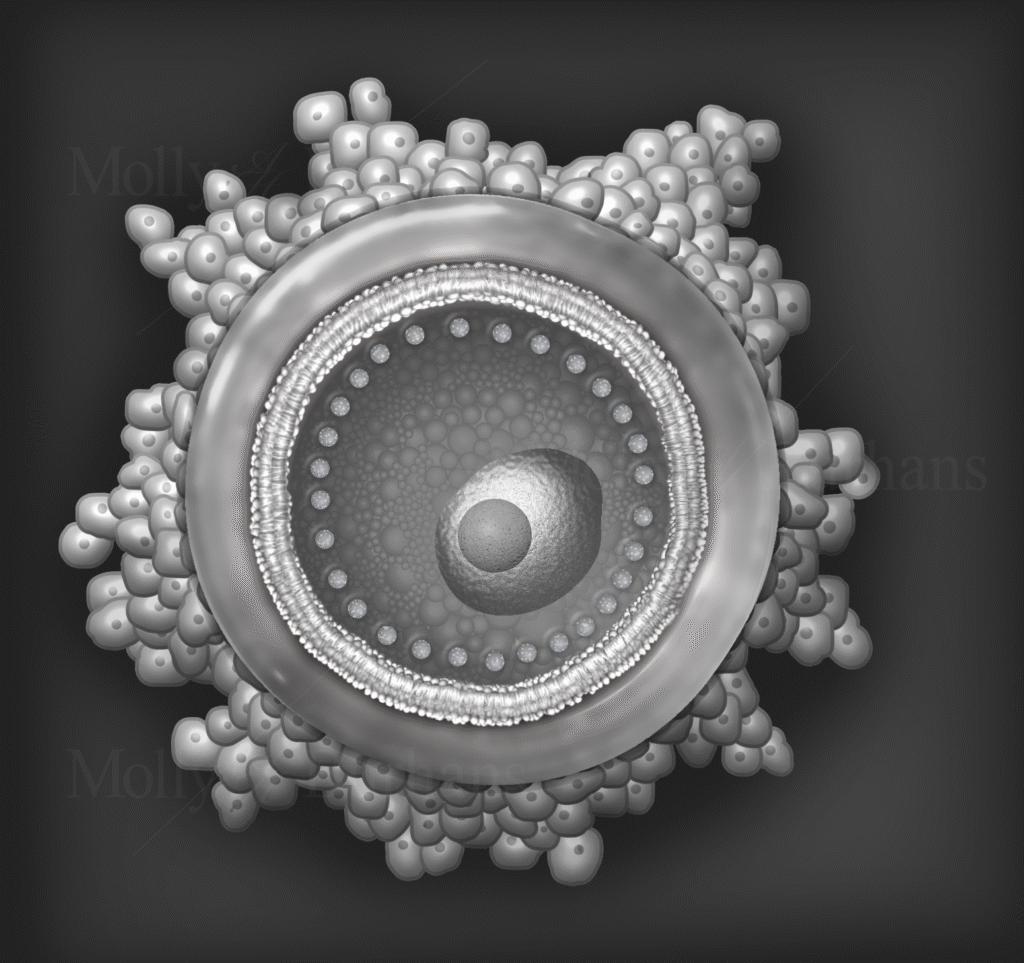
Ovum
digital design programs, pencil
2021
“Nature is painting for us, day after day, pictures of infinite beauty.”
— John Ruskin
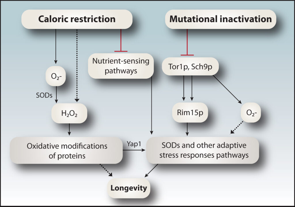
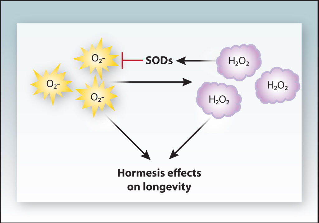
Figure 1 + Figure 2: Hormesis Explained
digital design programs
2012
Both hydrogen peroxide and superoxide anions have been implicated in hormesis effects that promote longevity. Whether superoxide anions can induce hormesis effects directly or indirectly (blue dashed arrows) via their conversion into hydrogen peroxide by SODs remains unclear. Importantly, the levels of superoxide anions and hydrogen peroxide are regulated by SOD activity. Hydrogen peroxide increases and promotes SOD activity that decreases superoxide levels (red arrows), thus creating a feedback regulatory mechanism that promotes hormesis effects by maintaining hydrogen peroxide at homoeostatic levels.
PUBLICATION: Paula Ludovico, William C. Burhans, Reactive oxygen species, ageing and the hormesis police, FEMS Yeast Research, Volume 14, Issue 1, February 2014, Pages 33–39, https://doi.org/10.1111/1567-1364.12070
Diocesan Data by Year
ESRI tools and software
2018
This video demo showcases an interactive map application developed by Molly Burhans that displays the year of the most recent available data for each Catholic diocese. Built using Vatican statistical records, Catholic Herarchy data, and GoodLands’ diocesan data and mapping, the visualization reveals geographic patterns in data availability over time. While most dioceses feature recent data, some regions show earlier cutoff points—particularly those with records ending before the 1950s—highlighting disparities in historical data continuity and availability.
Bishop Ages and the Extraordinary Ordinary Birthday Map Application
ESRI tools and software
2017
This video demo presents an interactive map application created by Molly Burhans that visualizes the ages of Catholic bishops across dioceses. The map highlights dioceses in yellow where the current bishop is above the typical retirement age of 75, providing a clear, visual overview of leadership transitions within the Church. Designed as part of GoodLands’ suite of ecclesiastical planning tools, the application blends demographic data with geographic context to support strategic leadership planning and ecclesial governance.
Catholics Hierarchy: General Overview
ESRI tools and software
2018
This video demo presents a map application developed by Molly Burhans that offers a general overview of the global Catholic hierarchy. The app displays ecclesiastical boundaries—such as dioceses, archdioceses, and ecclesiastical provinces—alongside key statistics for each jurisdiction. Users can explore geographic relationships within the Church’s administrative structure and access foundational data that supports planning, research, and global coordination. The visualization provides a comprehensive snapshot of the institutional Church’s presence and organization across the world.
Use the arrow(s) on the cover edge and pages or swipe to flip through the pages of the flipbook embedded above.
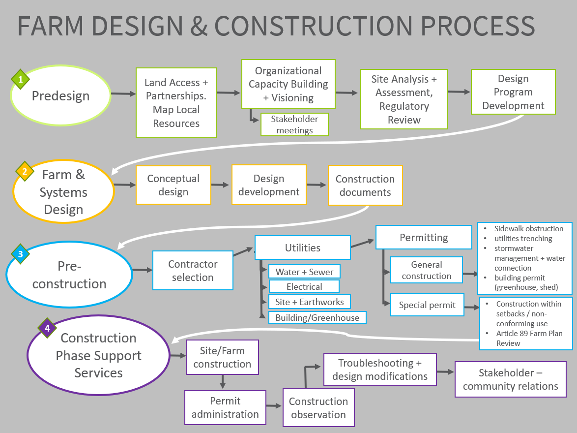
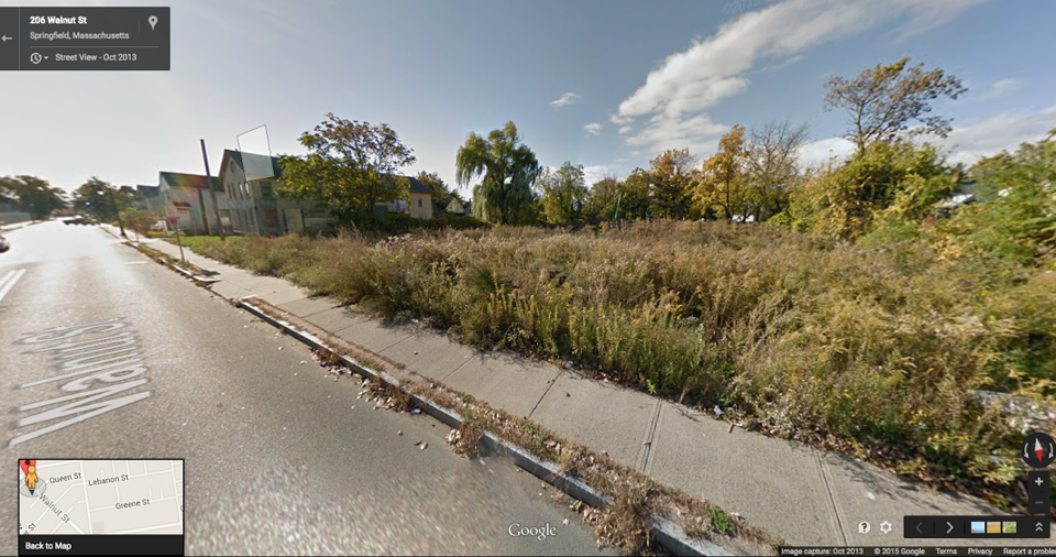
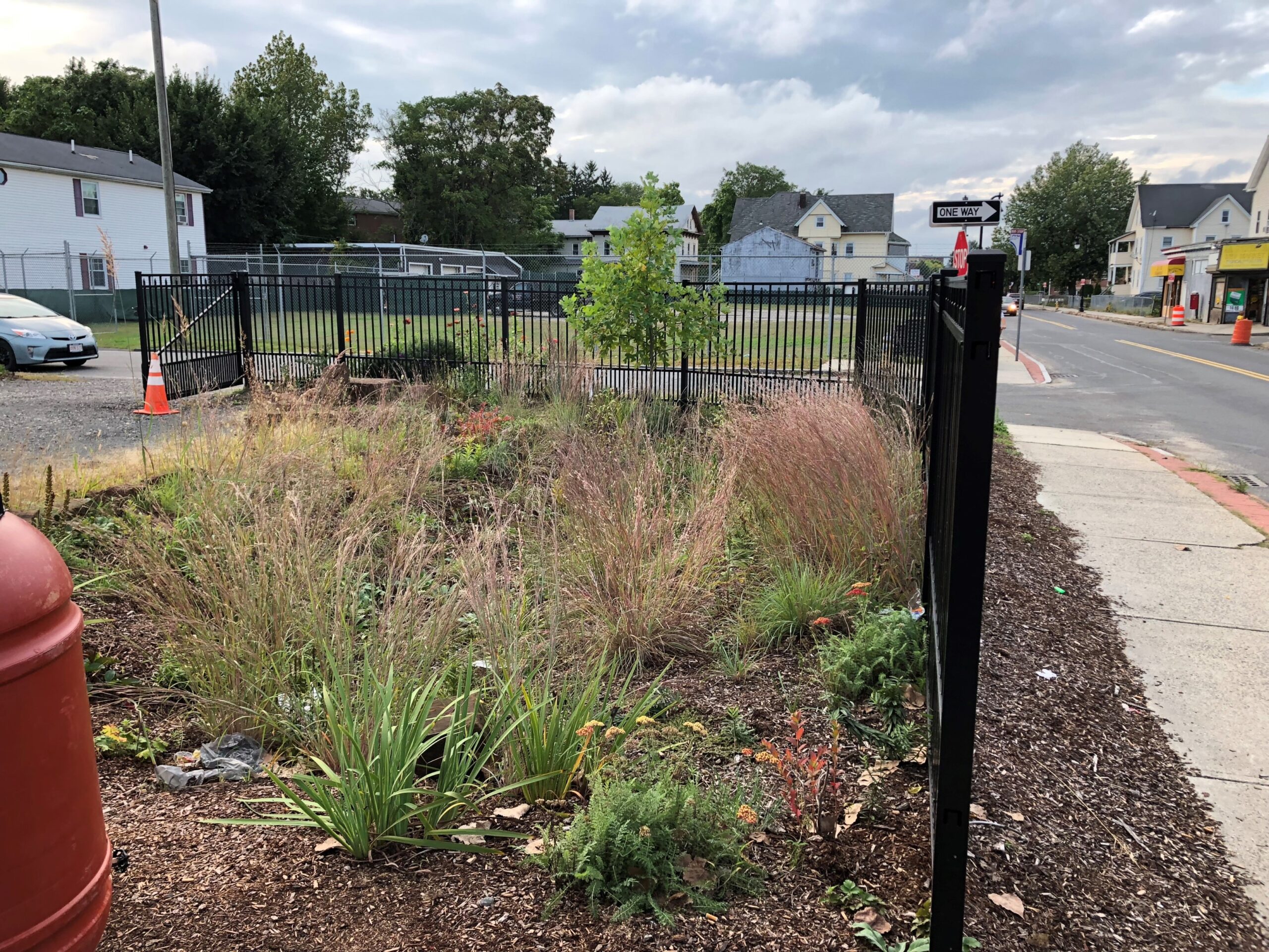
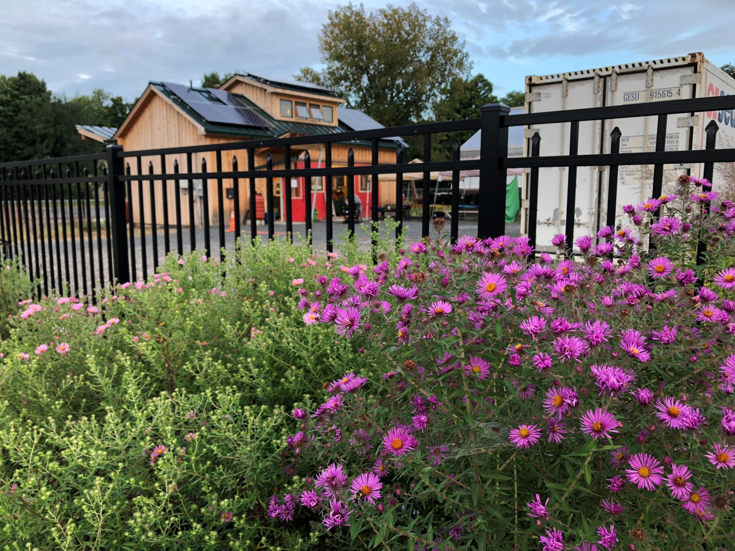
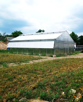
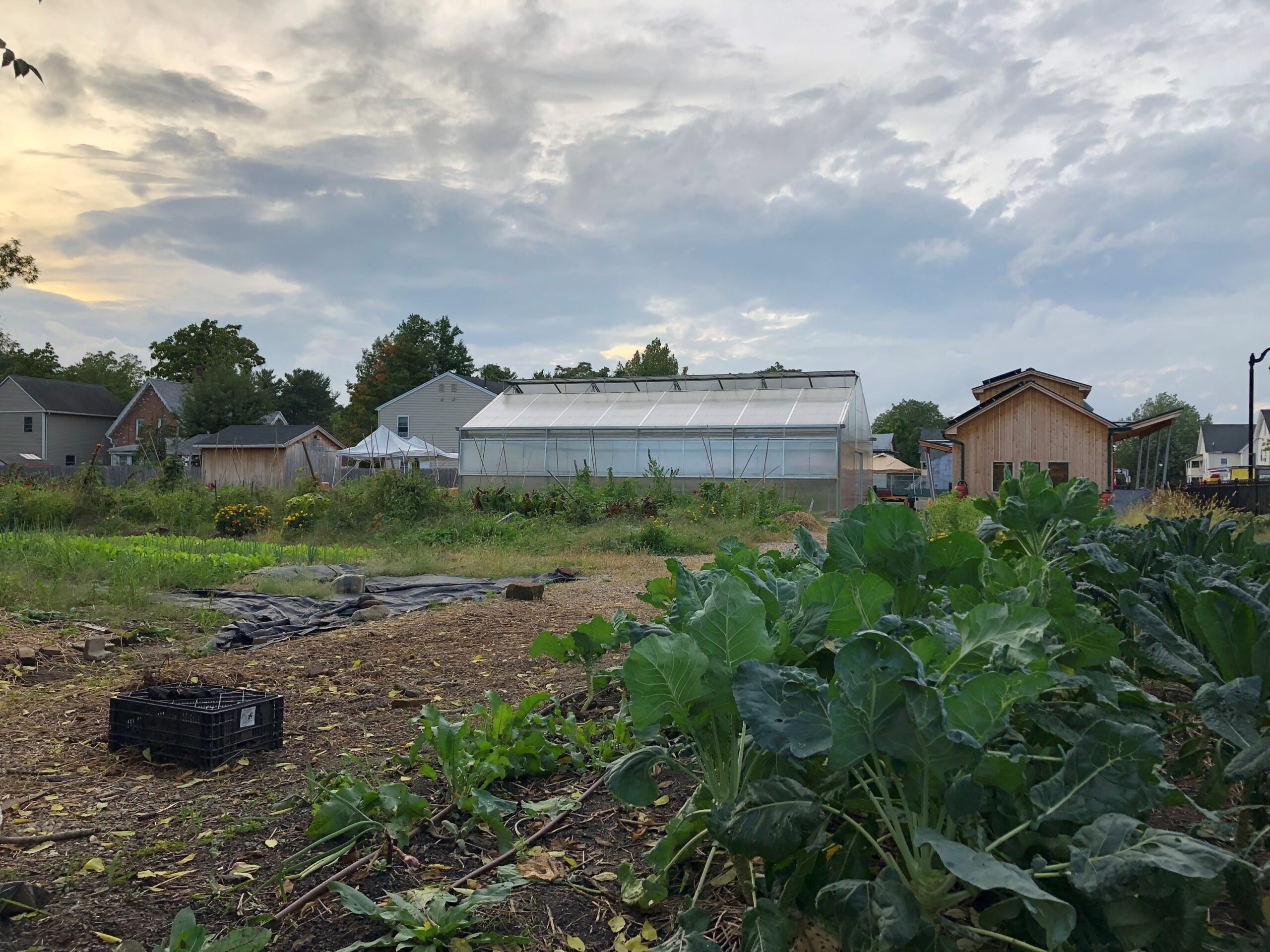
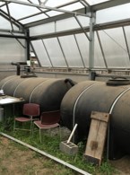
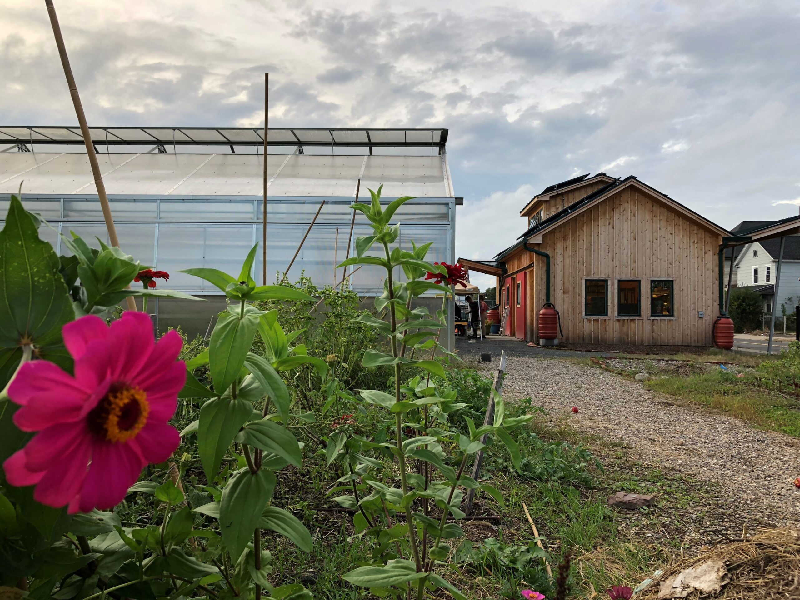
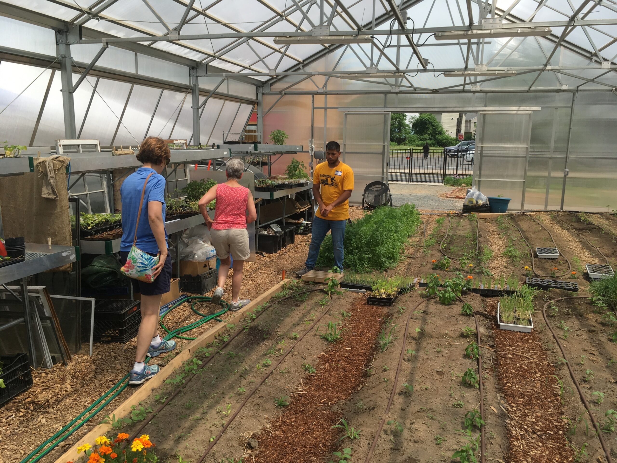
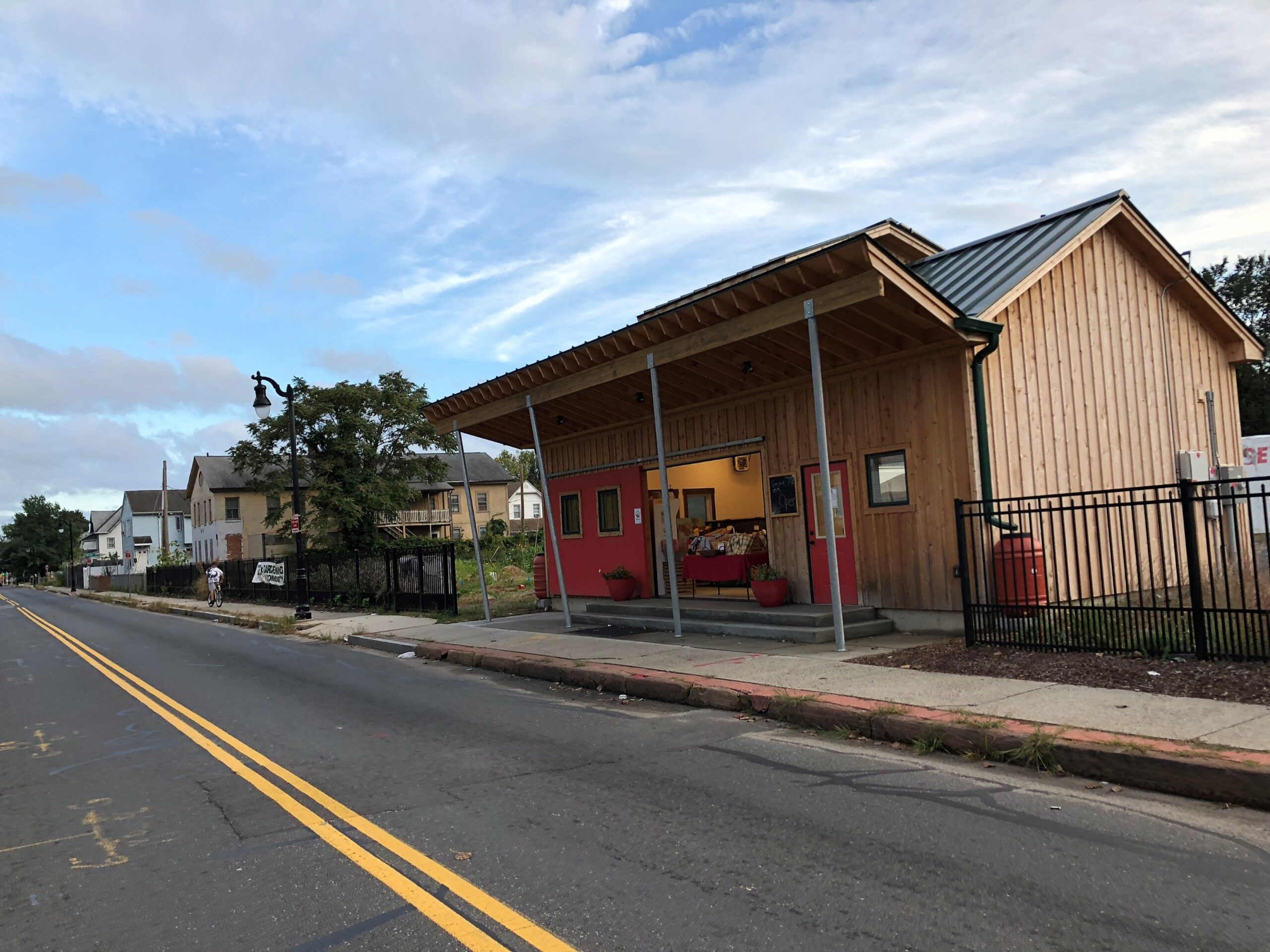
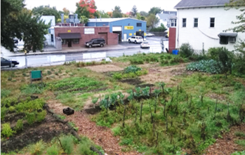
200/206 Walnut Street: Transformation of a Vacant Lot into a Vital Community Space
pen, ink, marker, Adobe suite, AutoDesk tools, Sketchup Tools, digital design tools, surveying
2014
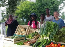
Molly Burhans developed a regenerative farm plan for Gardening the Community’s Walnut Street site in Springfield, MA, rooted in principles of ecological stewardship, food justice, and community resilience. The design integrated edible landscapes, water management, and multifunctional growing spaces tailored to the urban context and the organization’s youth-centered mission. This final plan was then reviewed and permits were approved in collaboration with Regenderative Design Group (RDG) landscape architects and engineers, as required for elements of the design such as hardscape, utility augmentation, and building.
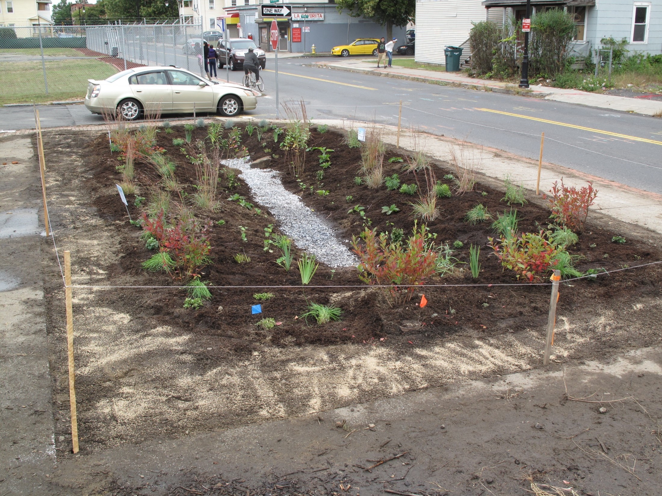
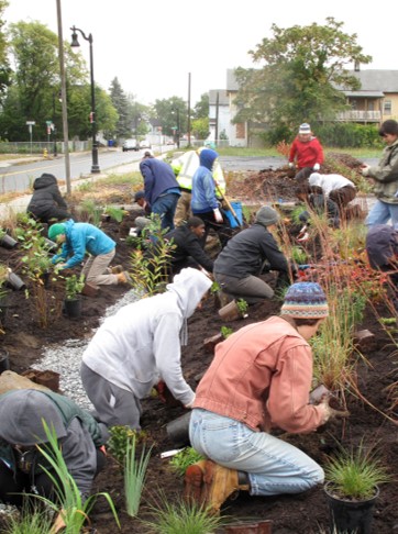
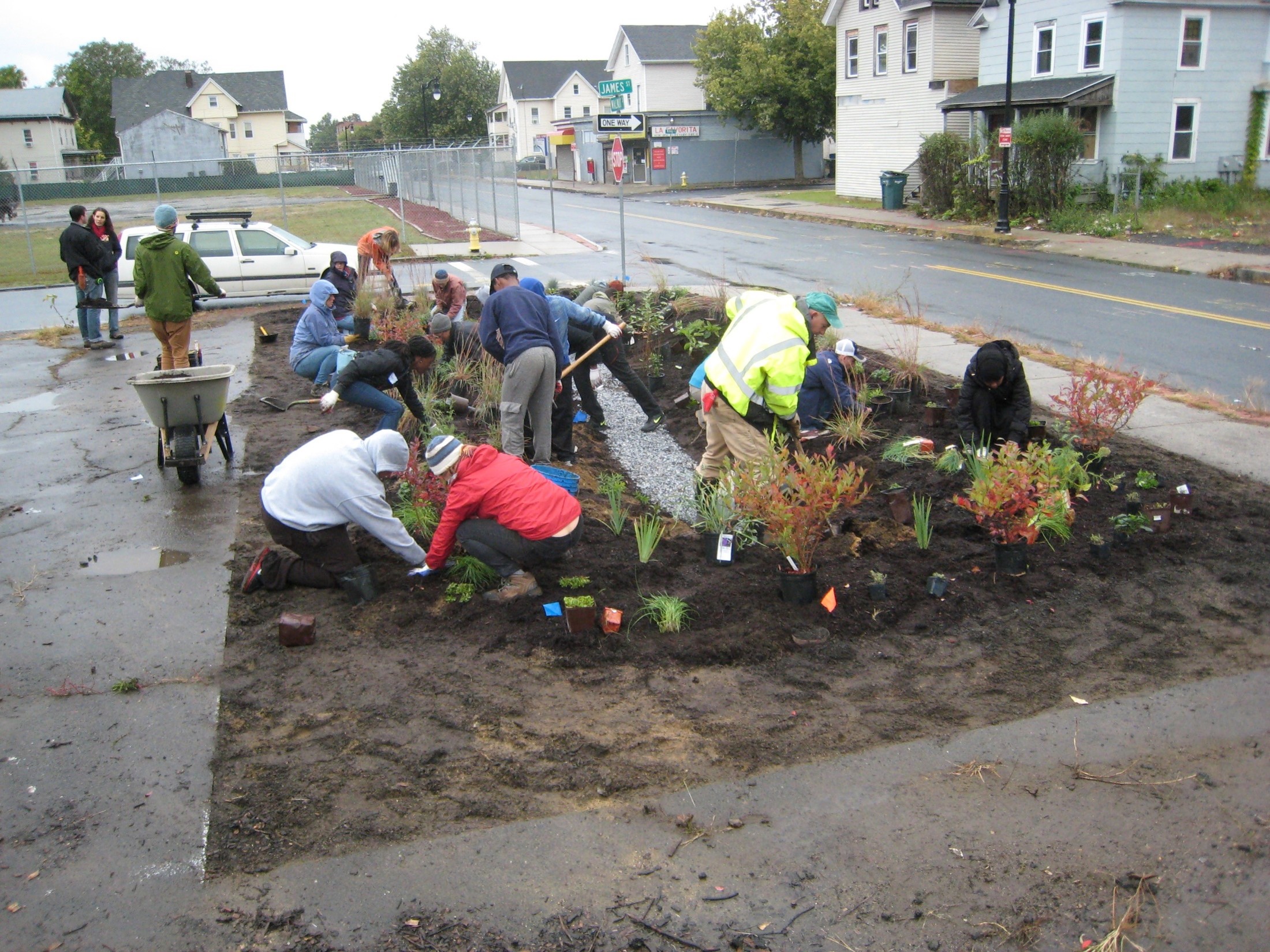
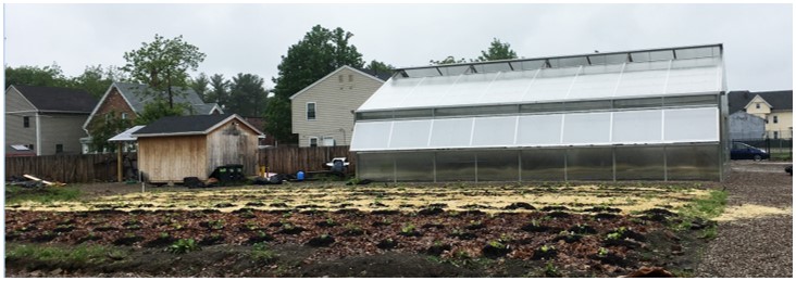
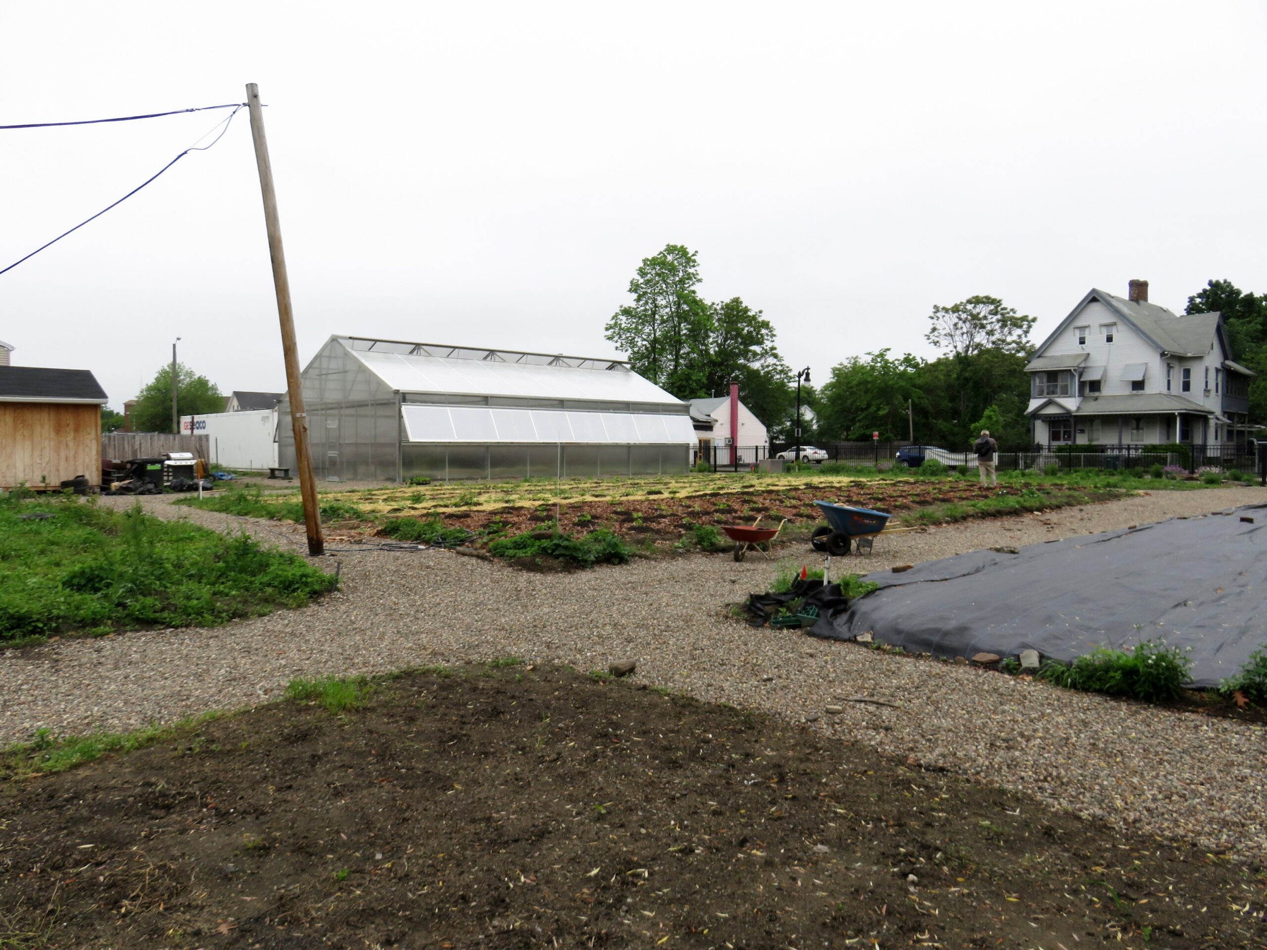
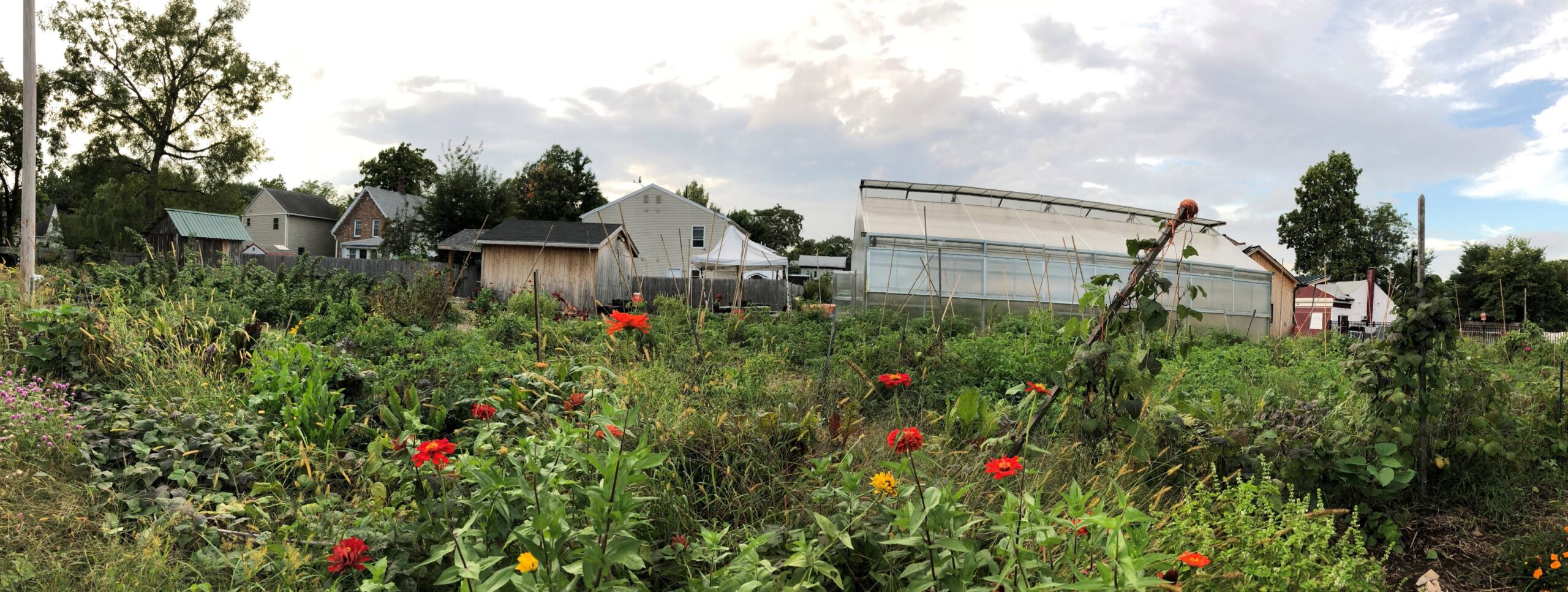
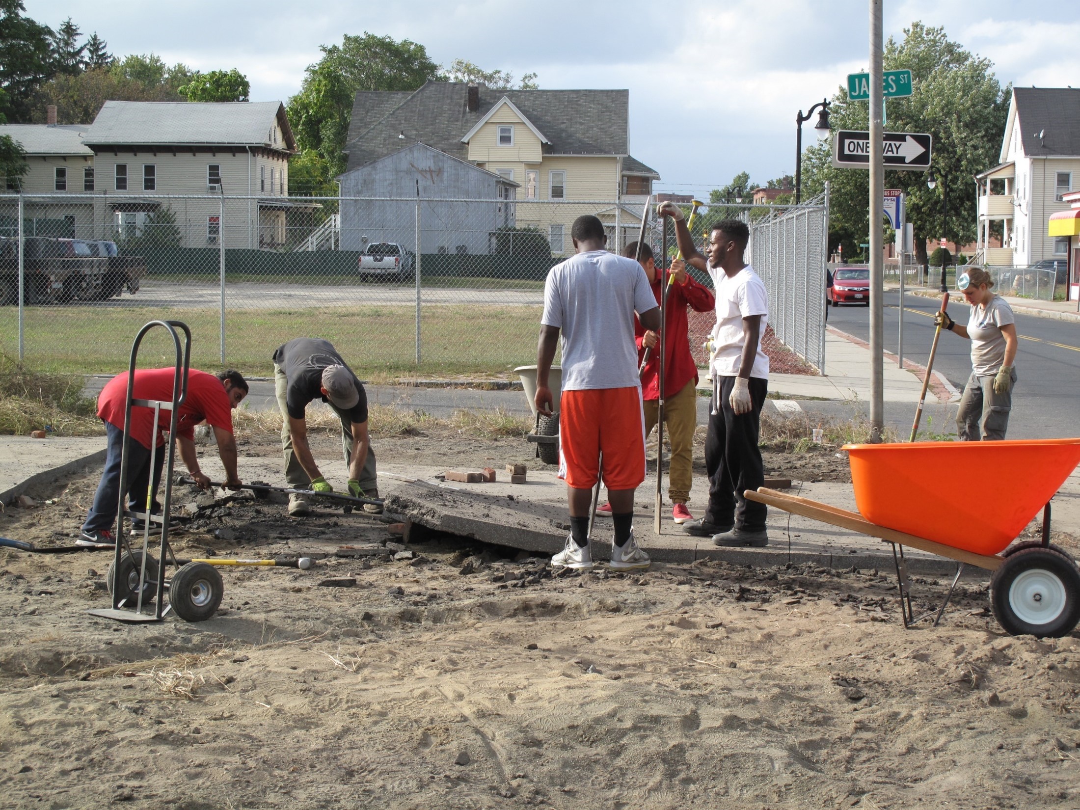
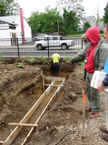
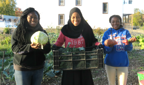
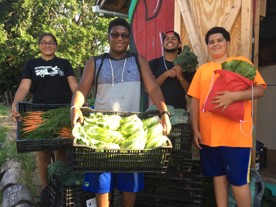
Design >>> Build of 200/206 Walnut Street
2015 – 2021
RDG coordinated the build out of Molly’s design with their build team and collaborators and community members involved in Gardening the Community. Today, the site is a flourishing hub in the neighborhood; producing fresh, healthy food, offering hands-on education, and cultivating opportunities and futures for the next generation of community leaders.
Los Angeles Archdiocese: GeoHub Proposal
ESRI tools and software, Adobe Suite
2018
The Los Angeles Archdiocese GeoHub proposal envisions a centralized geospatial platform to support mission-driven decision-making, with addressing homelessness as its core launch initiative. By mapping Catholic properties, services, shelters, and unmet needs across the region, the GeoHub would enable coordinated pastoral, charitable, and strategic responses—amplifying the Church’s role in healing systemic injustice through informed stewardship and collaboration.
Los Angeles GeoHub Scoping Workshop Proposal
Tools: Various digital design
2018
Imaginary City Property Portfolio Zoom: Website Header, Animated Scroll
Created in BIM, GIS, graphics, and webdesign programs
Lead designer, Molly Burhans, supporting designer Naumika Hejib
2024
Vincentian: Institute for Global Homelessness Proposal
Tools: Various digital design
2017
Ecologically Planning the Hartford Archdiocese
ESRI tools and software, Adobe Suite, Analog Design and Drawing Tools
2015
The Ecological Planning for the Hartford Archdiocese proposal outlines a comprehensive approach to assess and steward Church-owned lands for conservation, climate resilience, and community benefit. Through ecological analysis, geospatial mapping, and strategic planning, the initiative would identify high-value natural areas, restoration opportunities, and sustainable land-use pathways aligned with Catholic teaching. The proposed effort could support the Archdiocese in advancing integral ecology and responding faithfully to Laudato Si’.
ARCH6676 Course Site
Canvas LMS
2024
This video demo offers an inside look at Canvas LMS pages for my course ARCH6676: Cartography and Property at Columbia University GSAPP, Urban Design Dept., Spring 2024. It showcases how I use learning management systems, such as Canvas, to carefully curate course content and create a platform for communication and educational support, equipping students with tools, resources, and structured, modular guidance tailored to varying levels of expertise and experience.
Synod Maps: Safeguarding our Future — Children
ESRI tools and software, Adobe suite
2018
Oxide Mediated Longevity
digital design programs
2012
Publication: Ludovico P, Osiewacz HD, Costa V, Burhans WC. Cellular models of aging. Oxid Med Cell Longev. 2012;2012:616128. doi: 10.1155/2012/616128. Epub 2012 Dec 26. PMID: 23320129; PMCID: PMC3540889.
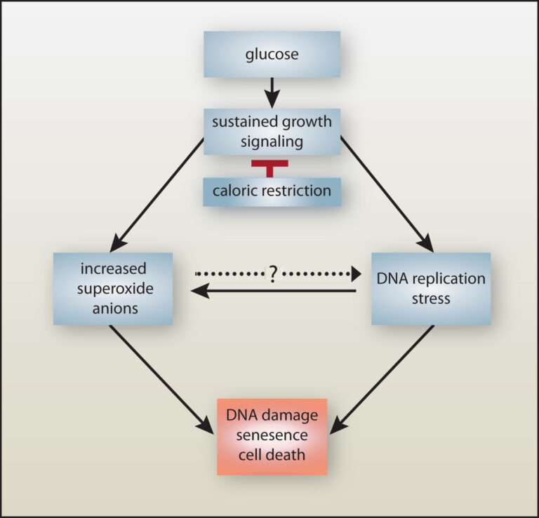
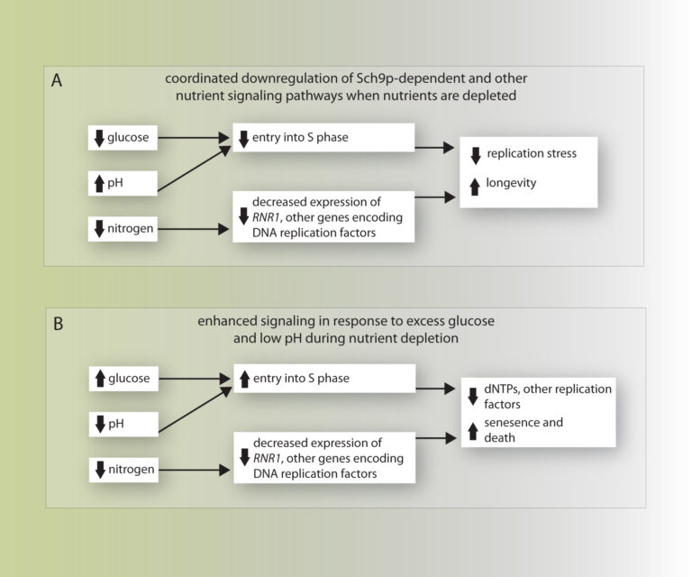
DNA replication stress-induced loss of reproductive capacity in S. cerevisiae and its inhibition by caloric restriction
digital design programs
2012
Published: Yes, Need to locate publication
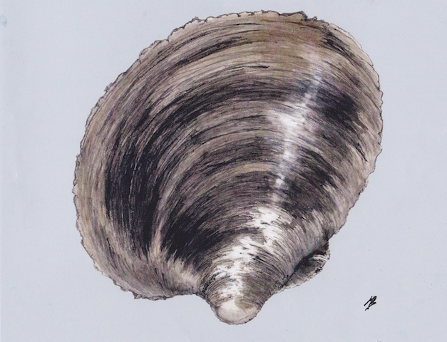
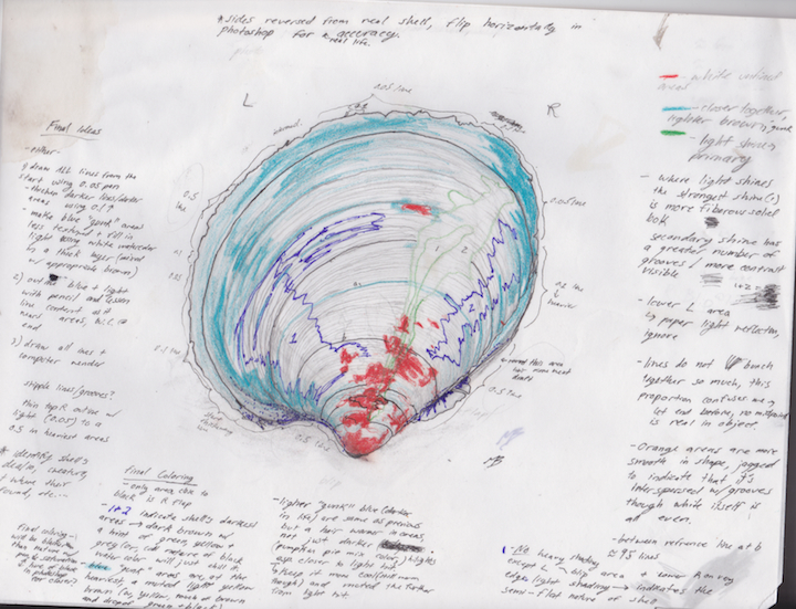
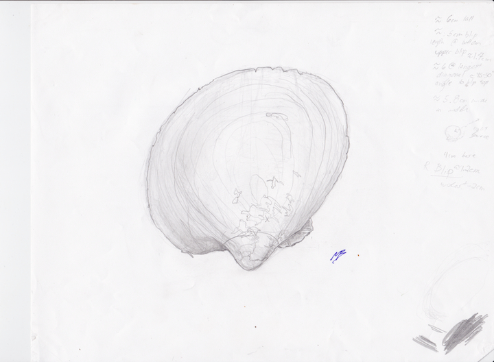
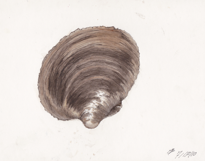
Quahog Clam (Mercenaria mercenaria)
watercolor, pencil, pen
2009
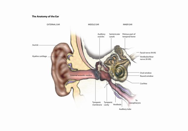
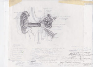
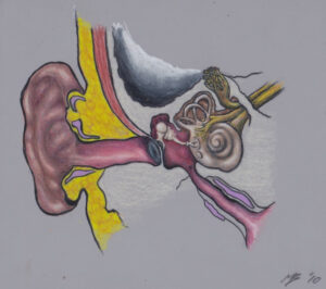
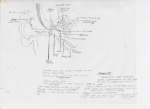
Anatomy of The Human Ear + Process Pieces
graphite, colored pencil, digital design programs
2009
Created during a 2009 biological illustration course offered through Cornell University, this work was developed in collaboration with a team, including medical professionals, from the Johns Hopkins’ Art as Applied to Medicine program. While detailed and grounded in anatomical study, these illustrations remain unpublished professionally, as anatomical media requires board certification for formal publication.
Synod Maps: Safeguarding our Future — The Planet
ESRI tools and software, Adobe suite
2018
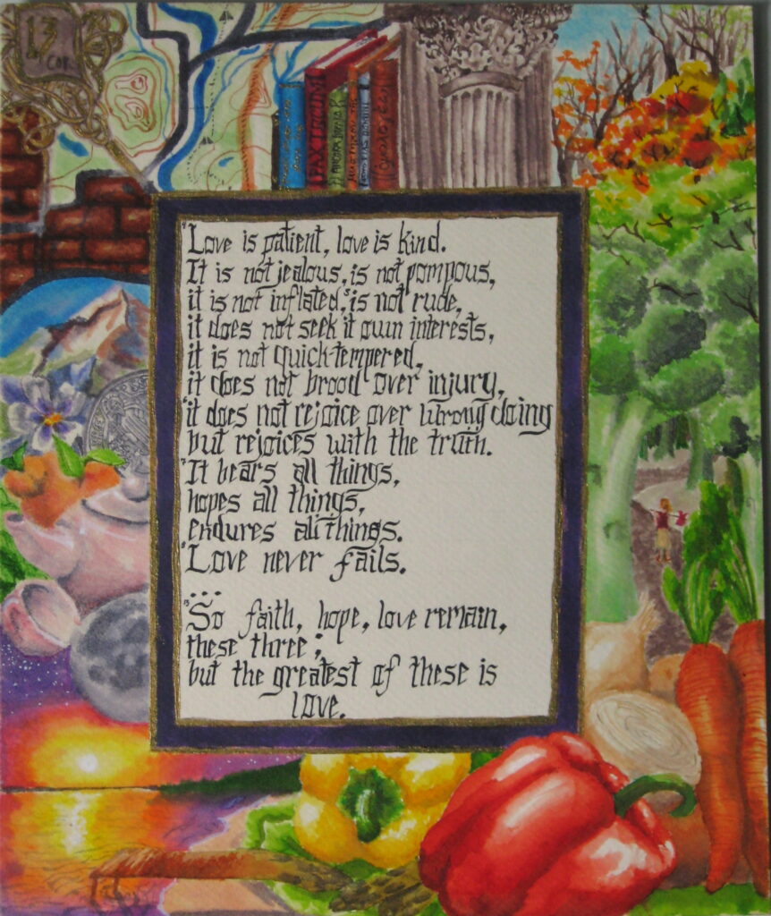
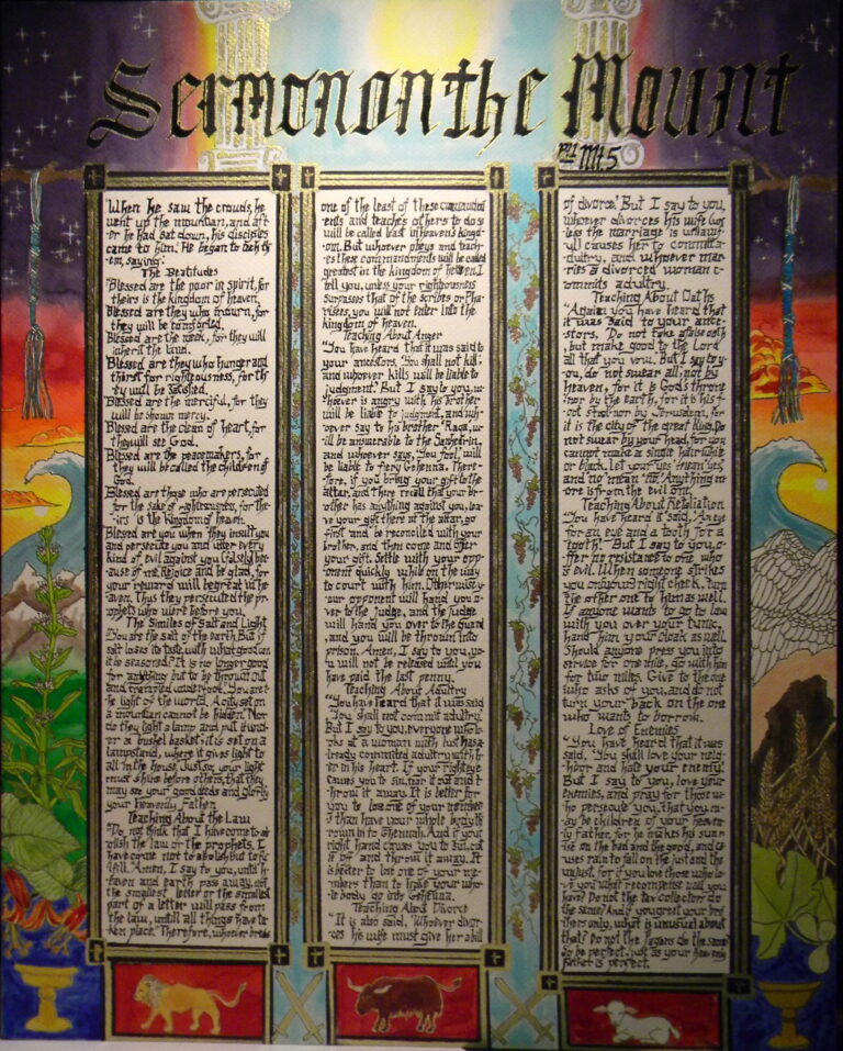
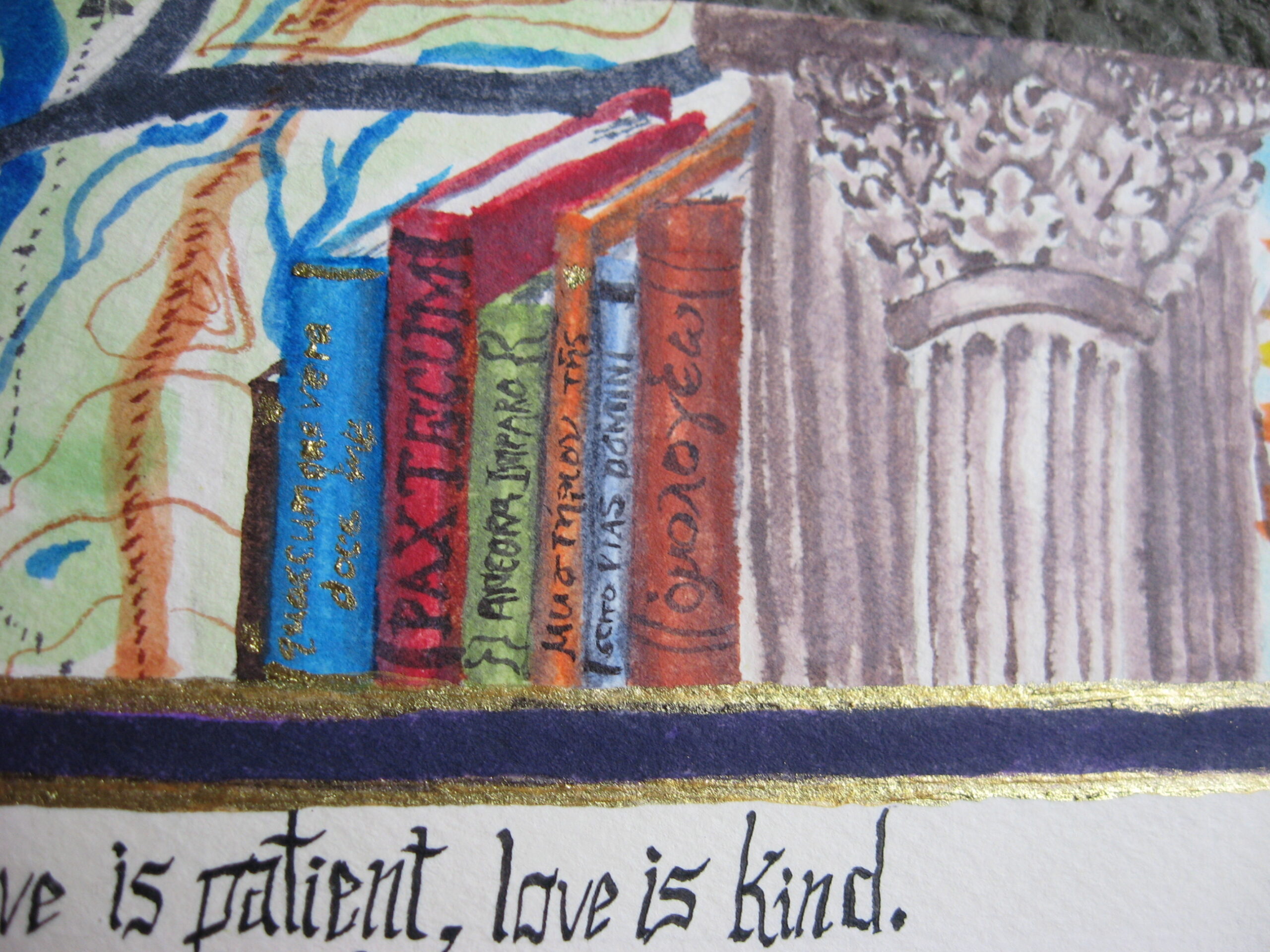
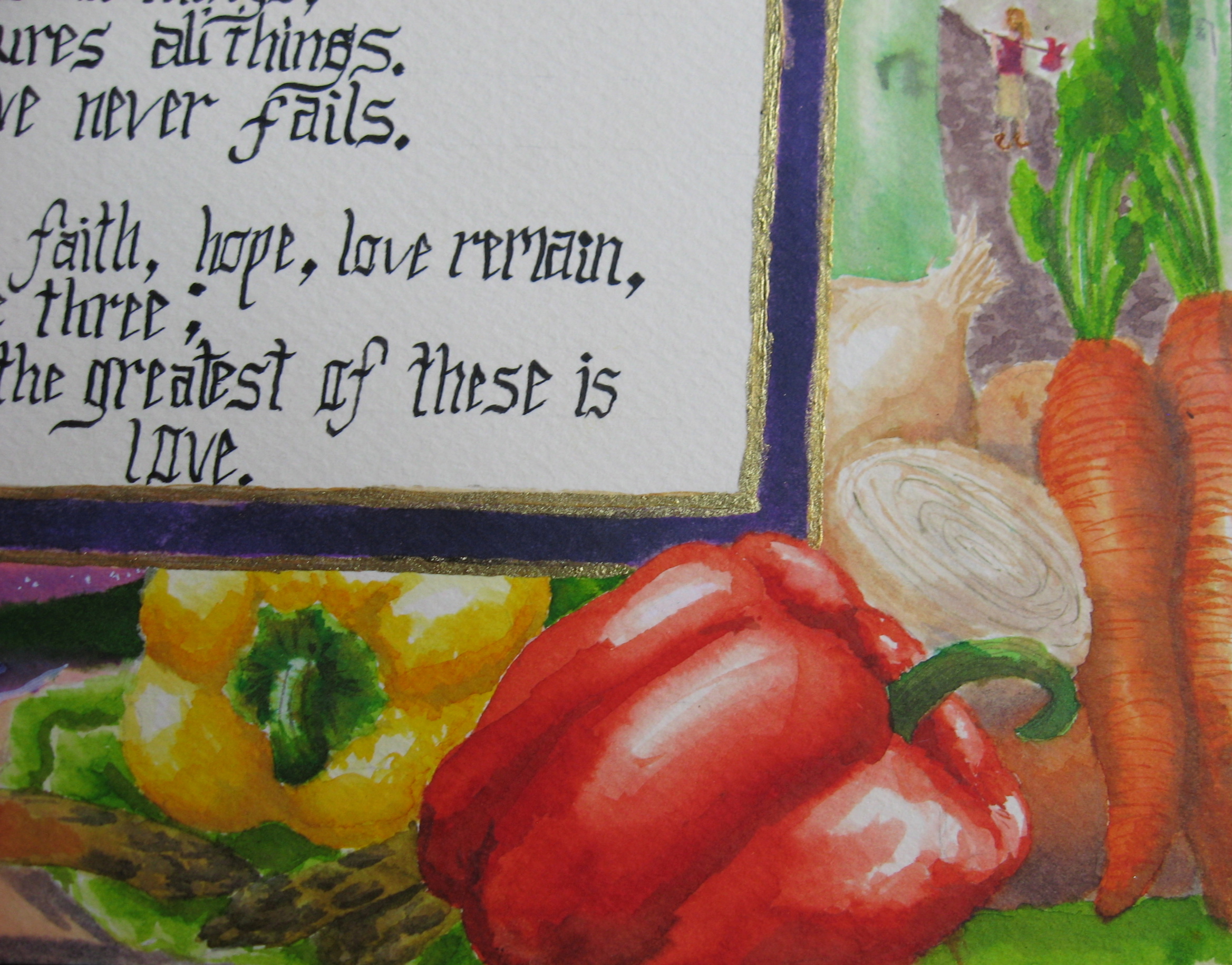
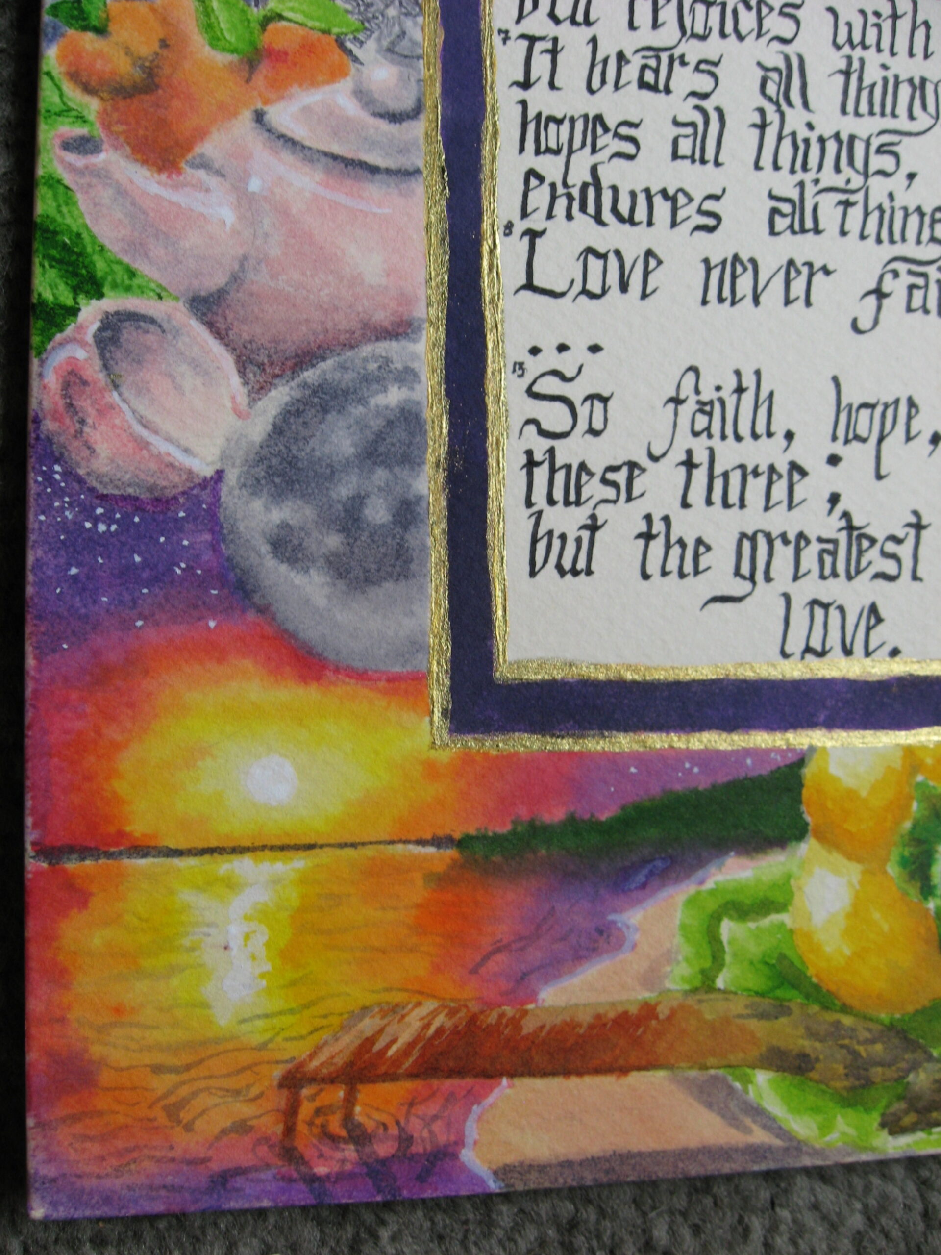
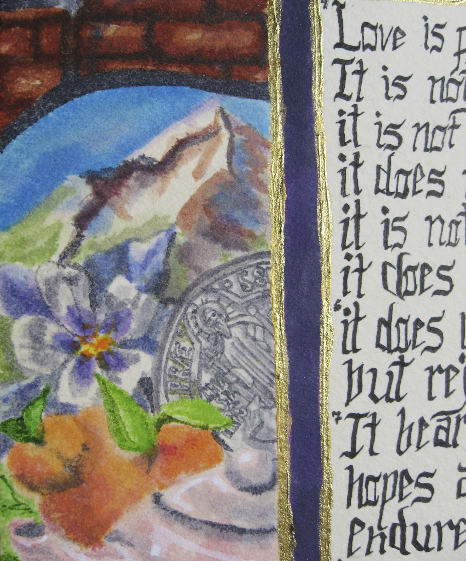
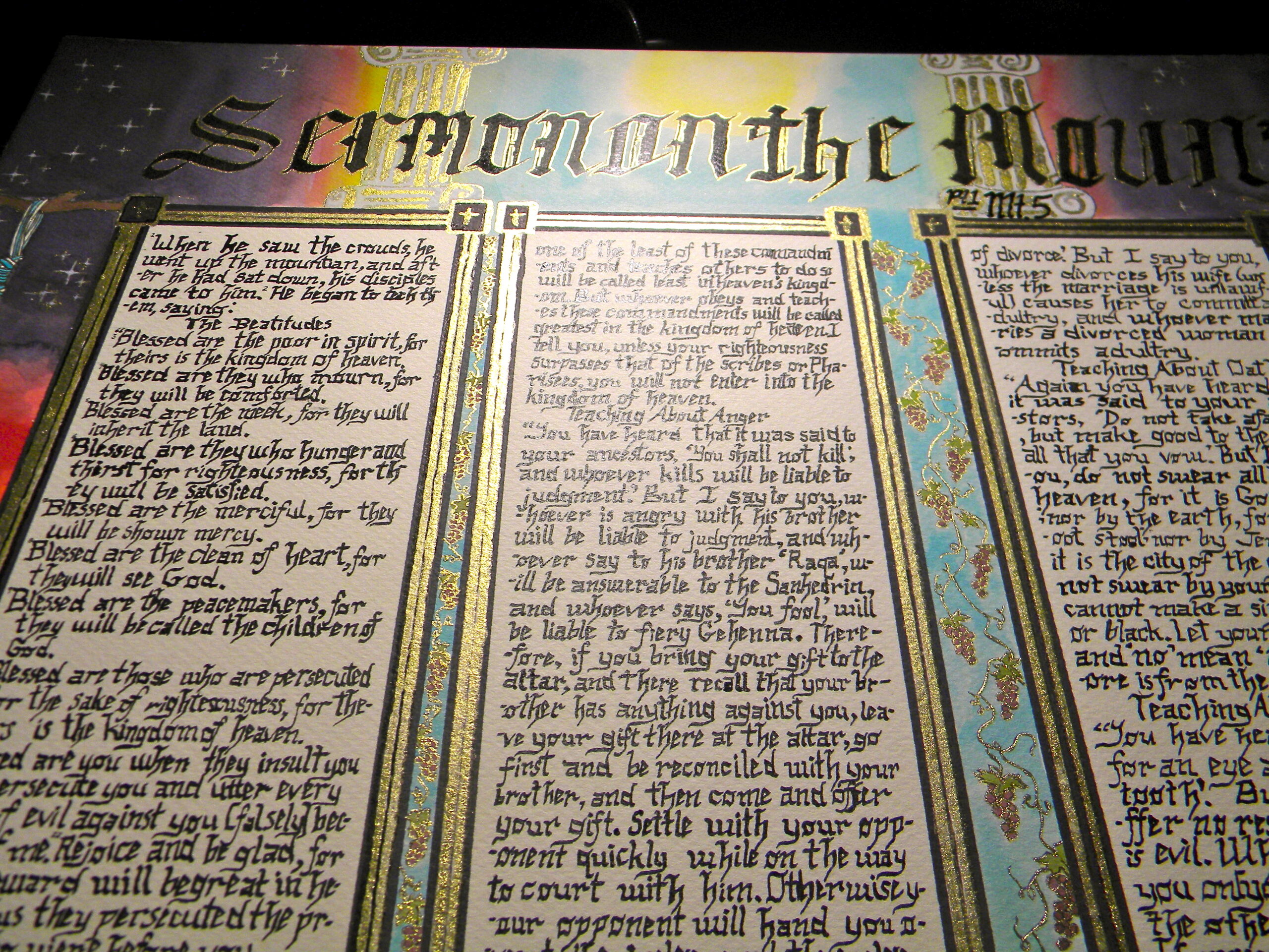
The Greatest of These is Love (Corinthians 13)
watercolor, calligraphy pen, brass suspended liquid, ink
2014
From Fresco to ArcGIS Pro
ESRI Ecosytem, Adobe Suite
2015
In this video, I bring Friar Ignazio Danti’s 16th-century fresco map of Venice from the Vatican’s Galleria delle Carte Geografiche into the 21st century. Using ArcGIS Pro, I transform the historic artwork into a 3D city model and overlay sea level rise projections to explore Venice’s future. A dialogue across centuries between cartographic art and modern spatial analysis.
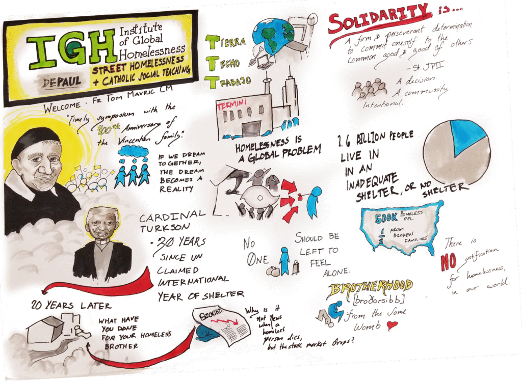
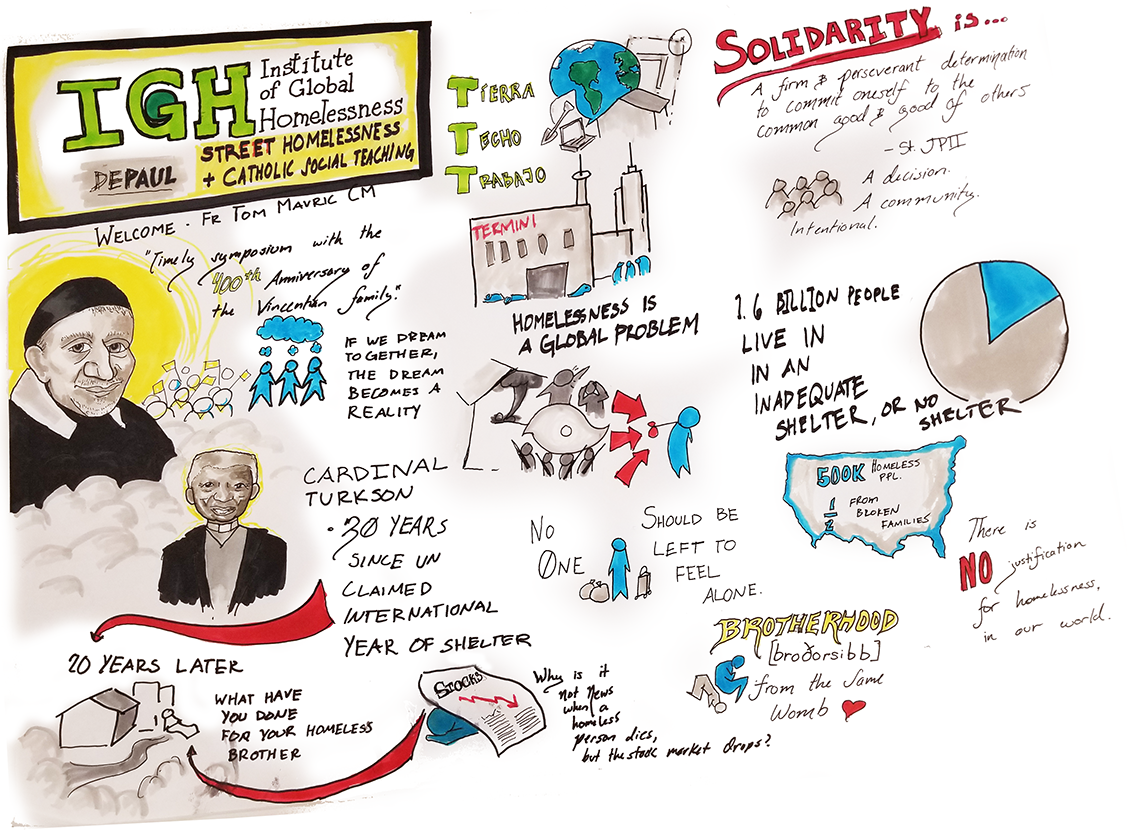
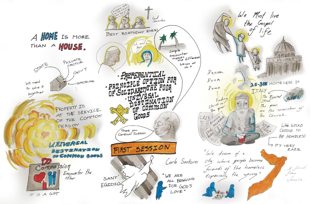
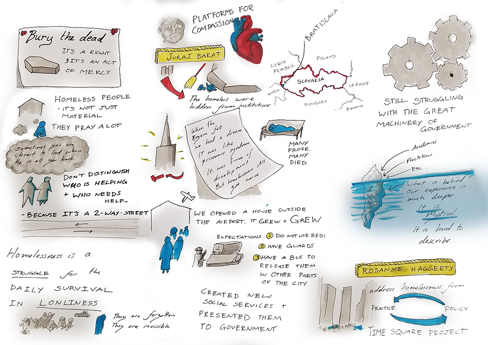
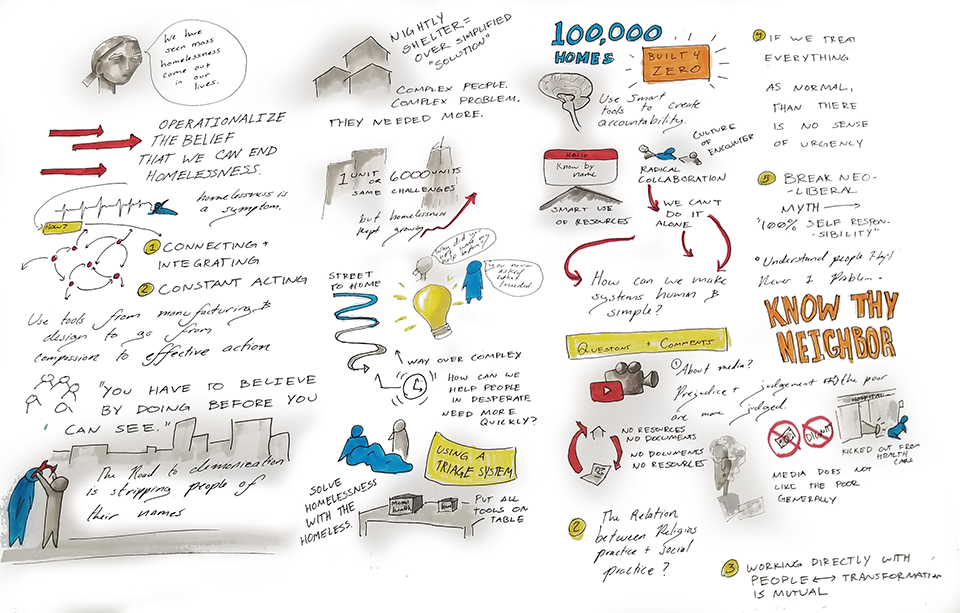
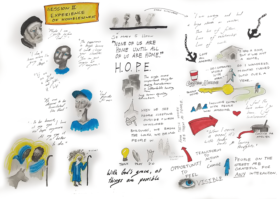
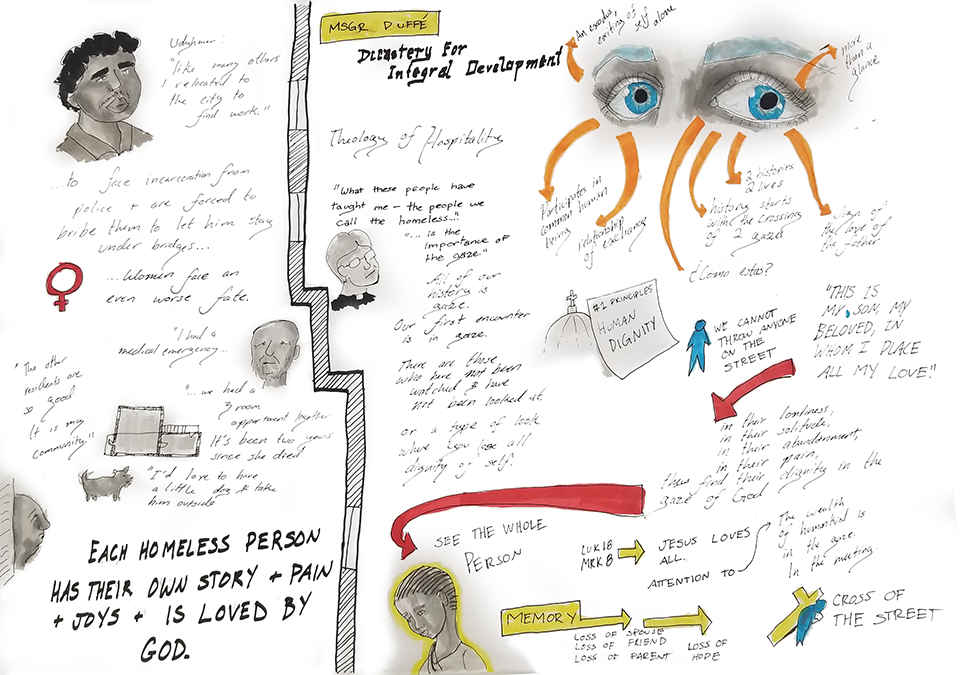
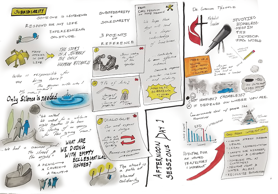
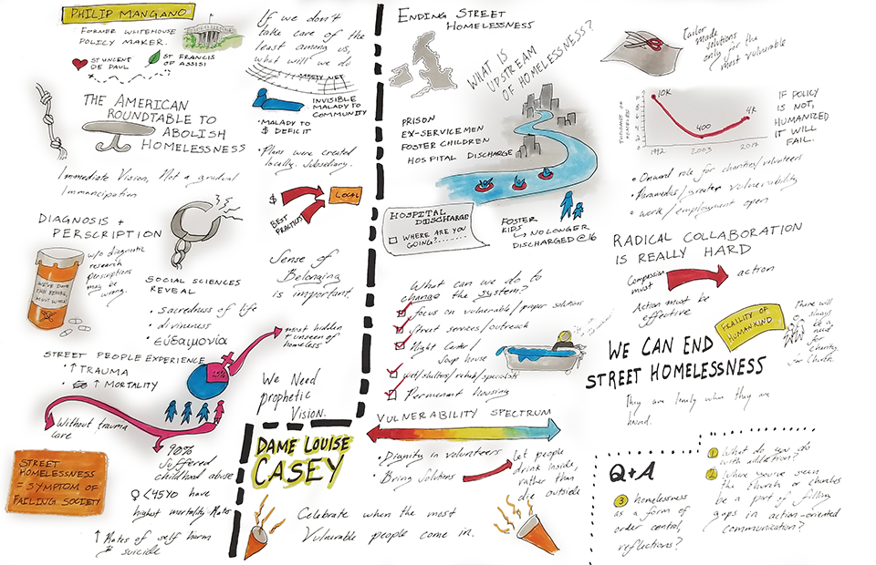
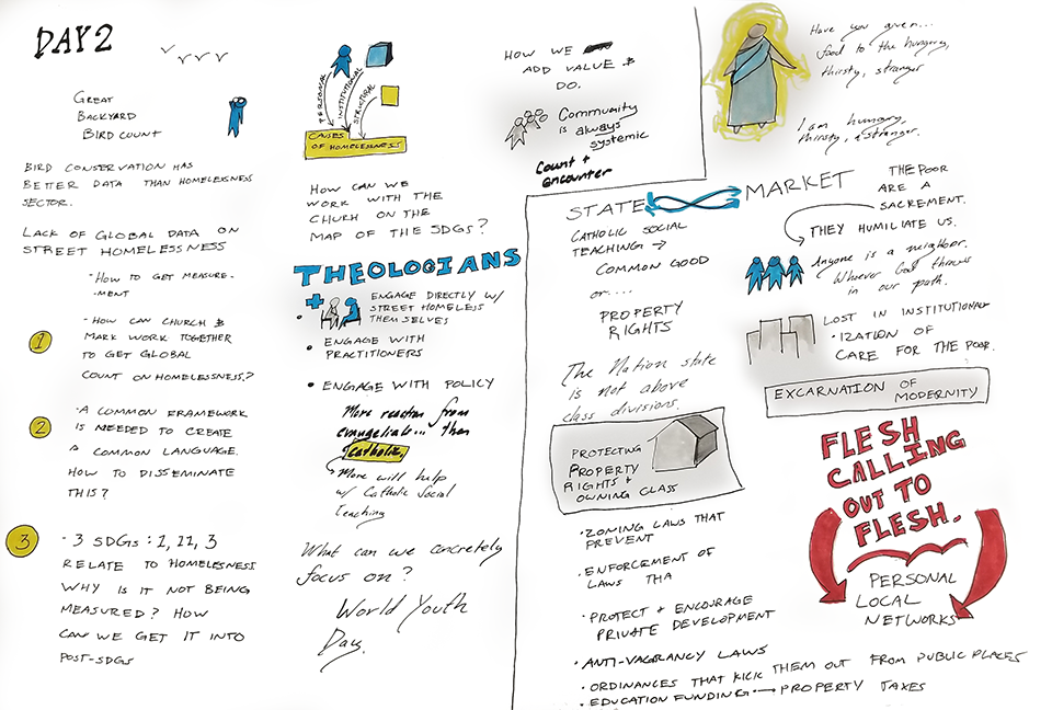
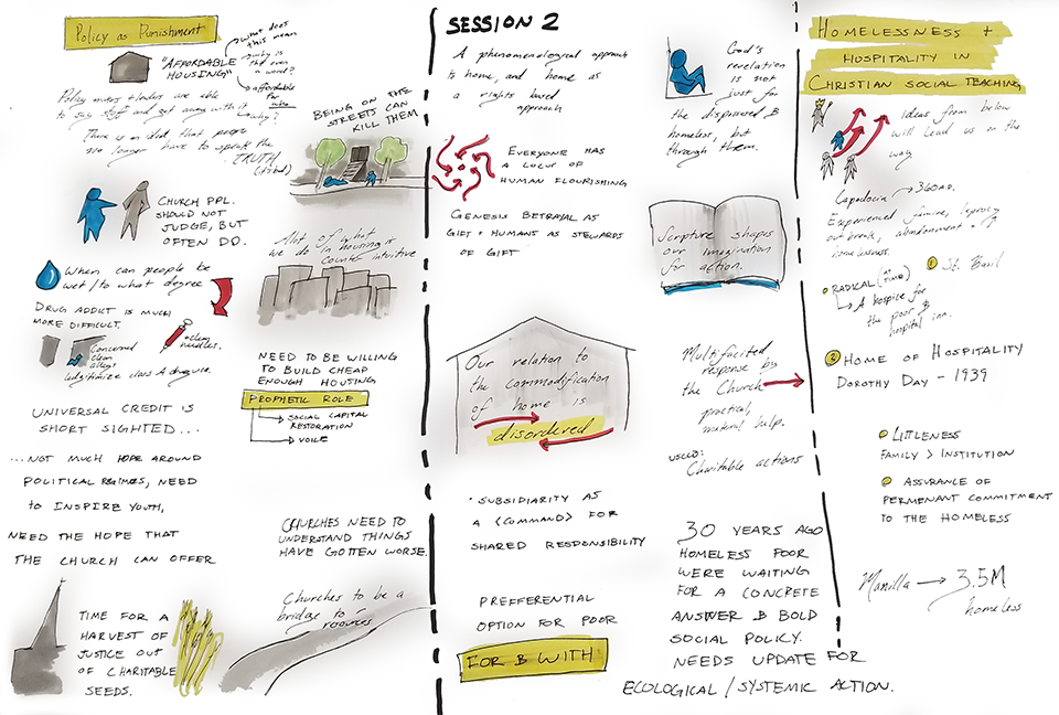
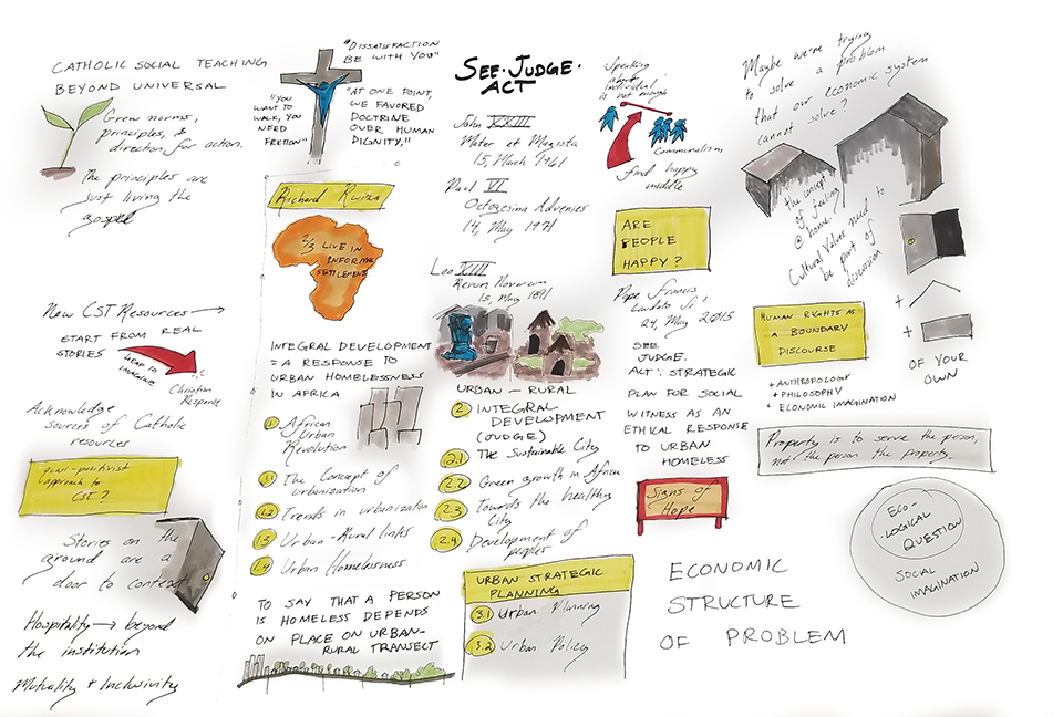
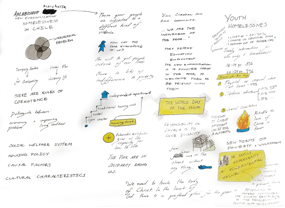
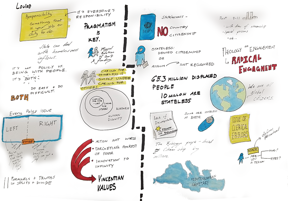
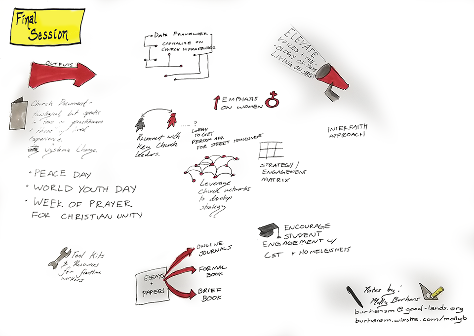
Live Graphic-Notetaking: Street Homelessness and Catholic Social Teaching
markers, pen
2018
Live graphic notetaking for the IGH (Institute for Global Homelessness) meeting in Rome; held in collaboration with the DePaul University IGH, Vatican IHD. I had the opportunity to visually captured the unfolding conversations, insights, and shared commitments in real time. This work translated complex discussions about homelessness, human dignity, systemic change, and faith-based action into vivid, accessible visuals. The notes included portraits of speakers, symbolic imagery, and key phrases or themes that emerged — from data-driven strategies to theological reflections. The result is a dynamic visual record that both documented and deepened engagement with the session’s content, providing participants with a shared map of ideas, goals, and collective vision.
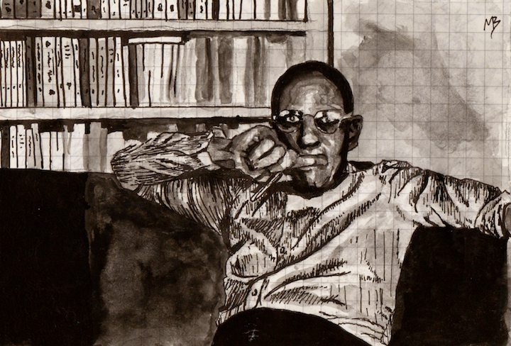
Focault
watercolor, ink
2009
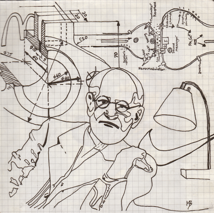
Freud
ink
2009
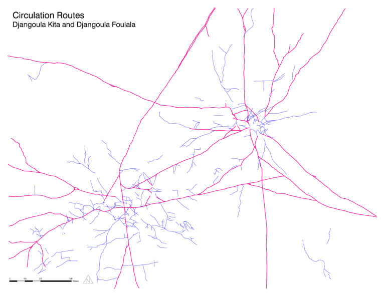
Circulation Routes
Google Earth Engine, Adobe graphic programs
2015
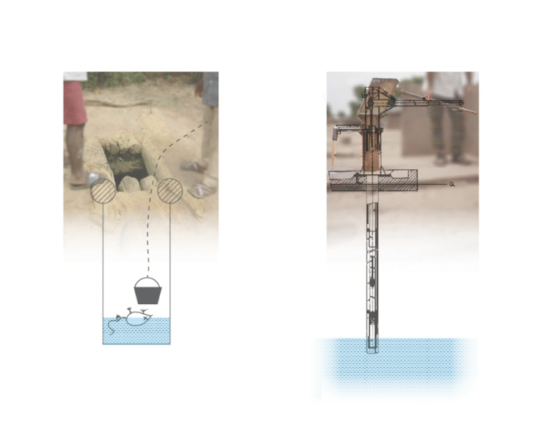
Open Well vs. Closed Well
Adobe graphic programs (underlaying images are public domain)
2015
An Ecological Foundation: A Framework for Understanding Sustainable Agricultural Strategies and Water Management in Djangoula Kita and Djangoula Foulala, Mali, West Africa
Digital Design programs, Adobe Suite, Google suite, Google Earth Engine, ESRI tools and software
Co-Authors: Molly Burhans, Chris Hendershot
2015
Abstract / Overview: Food and water security are necessary for the survival of any community. The villages of Djangoula Kita and Djangoula Foulala are presented with a significant opportunity through working with the non-profit organization, Mali Nyeta, to adapt their food and water management systems on their own terms before the shifting environment, in the wake of climate change, necessitates it.
This document explores possible water management and agriculture strategies that are suitable for the existing site and regional conditions of Djangoula Kita and Djangoula Foulala and how these selected water management and agriculture strategies may be incorporated into a new four-hectare women’s garden shared by the villages.
The research compiled is meant to provide information about the existing conditions of the villages, reveal bits and pieces about the lives of village residents, and illustrate a framework for finding strategies that could work for sustainably addressing the problems of villagers today in helping them prepare for tomorrow.
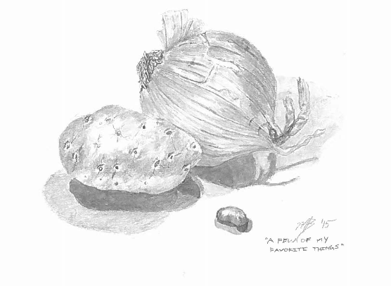
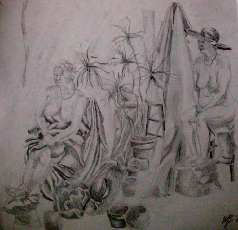
A Few of my Favorite Things
pencil
2015
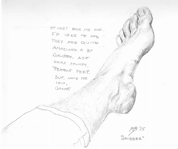
Grubber
Pencil
2015
The Queens of Something
Pencil
2014
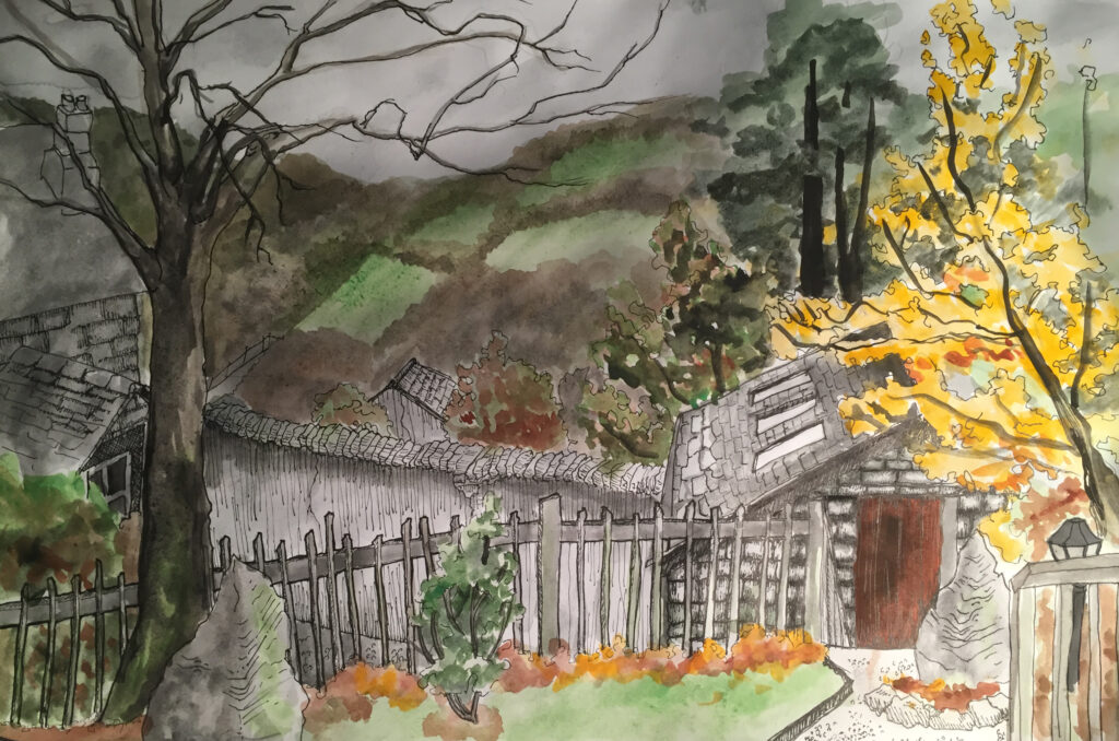
Winter in Wicklow, Ireland (for my dad, requiescat in pace)
watercolor and pen
2016
Two-Thousand-and-Eight
pen, watercolor, coffee
2008
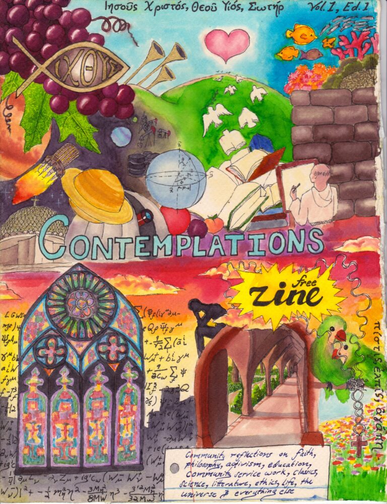
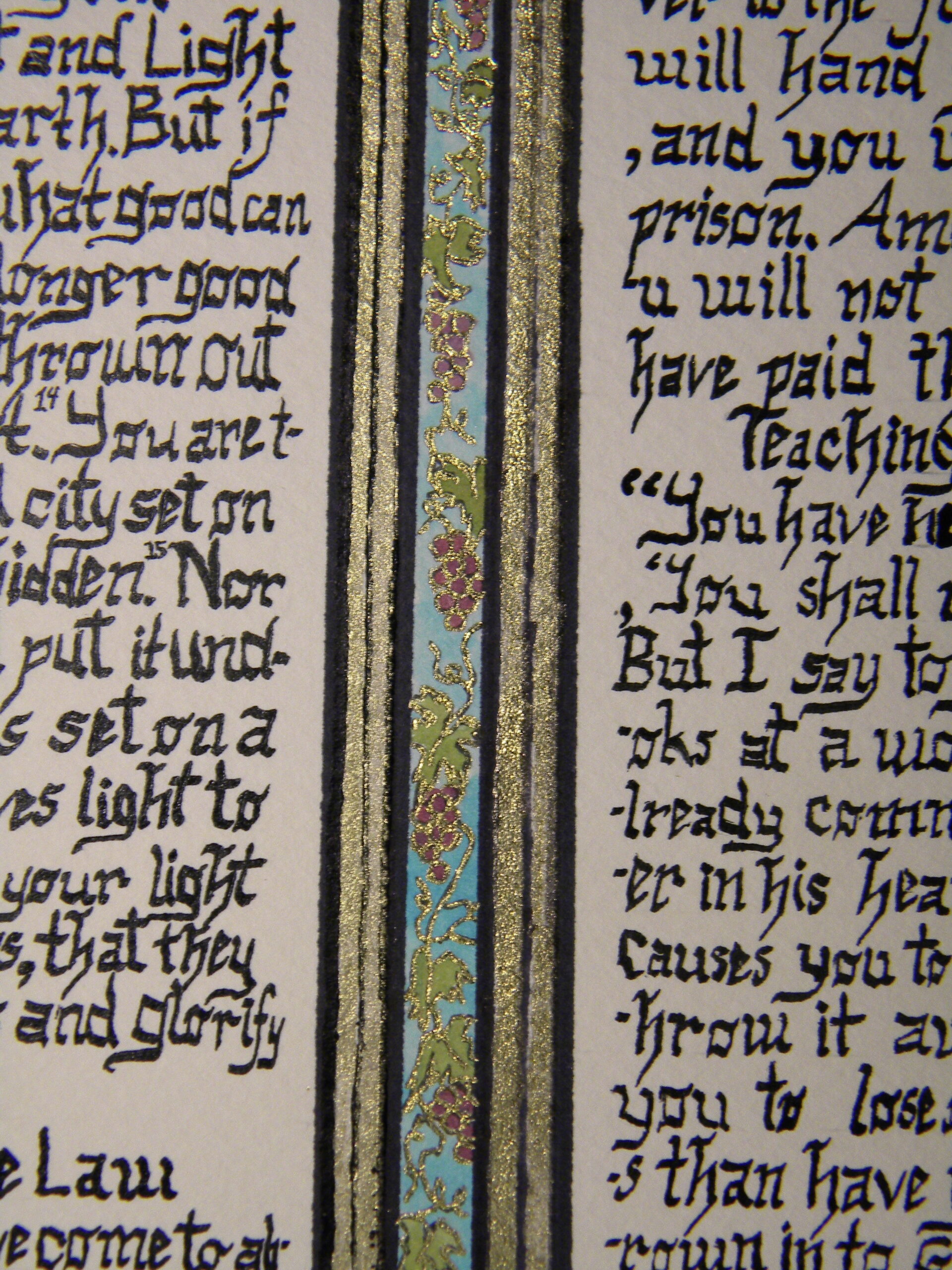
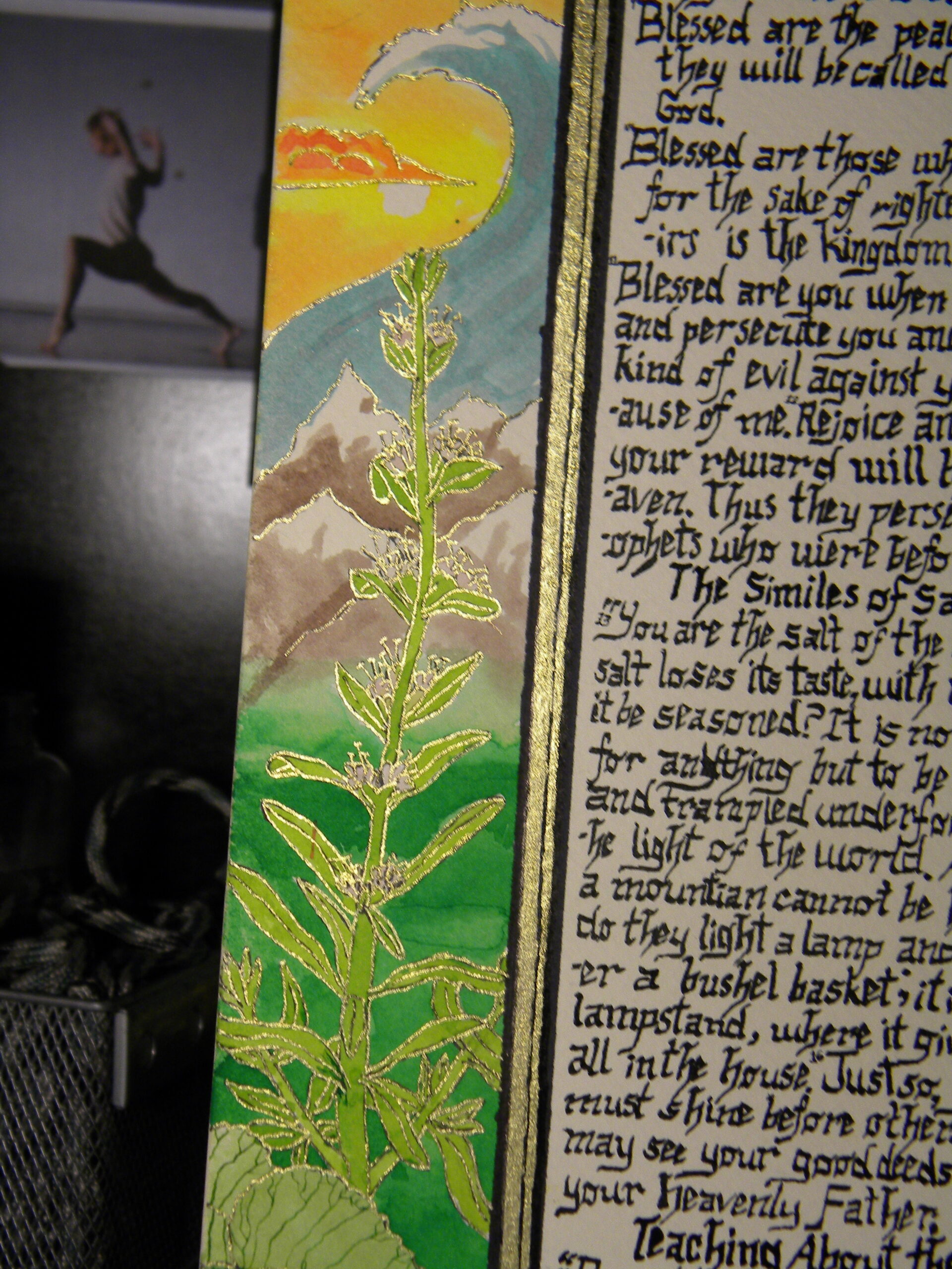
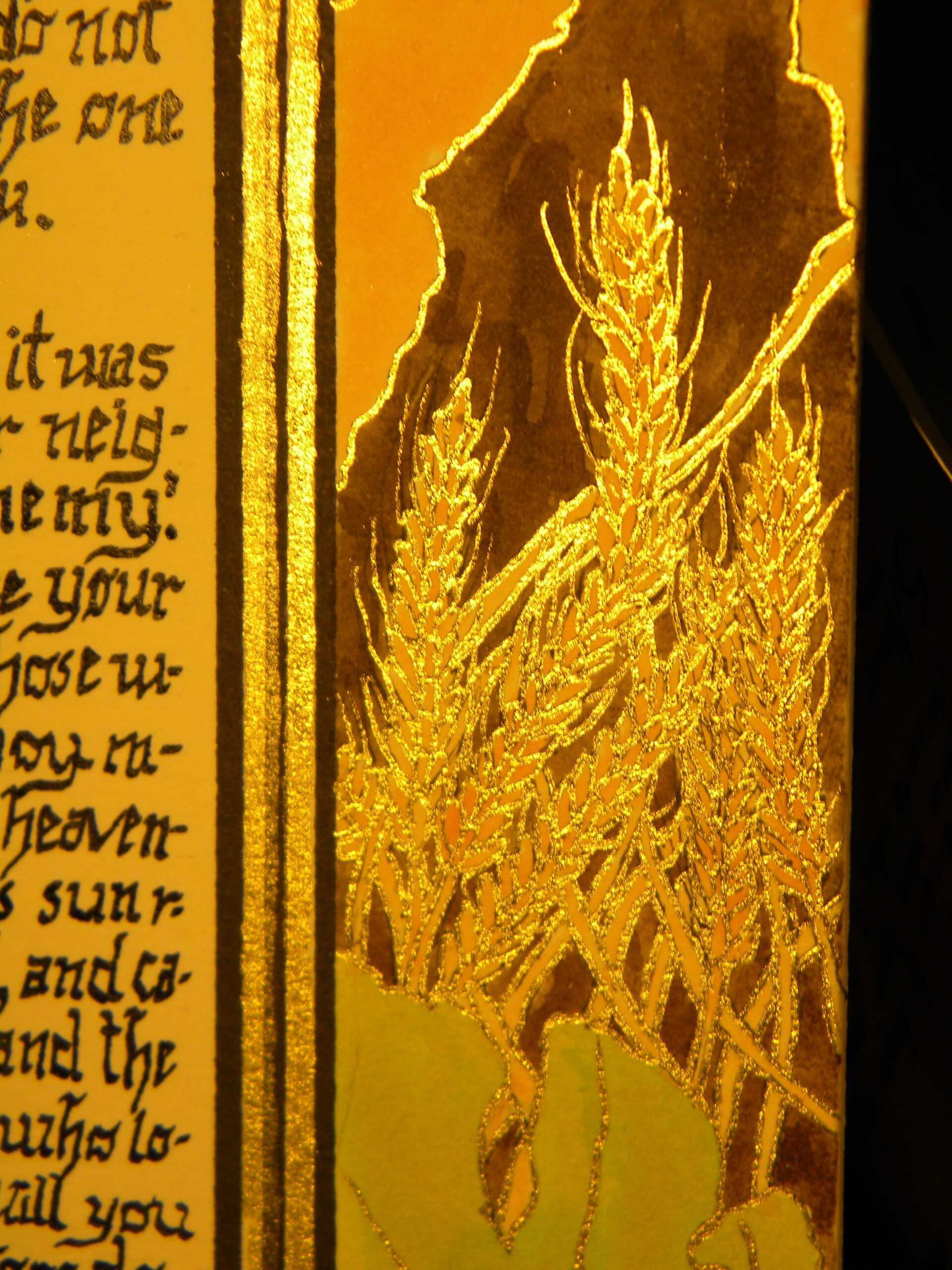
Contemplations
pen, watercolor
2014
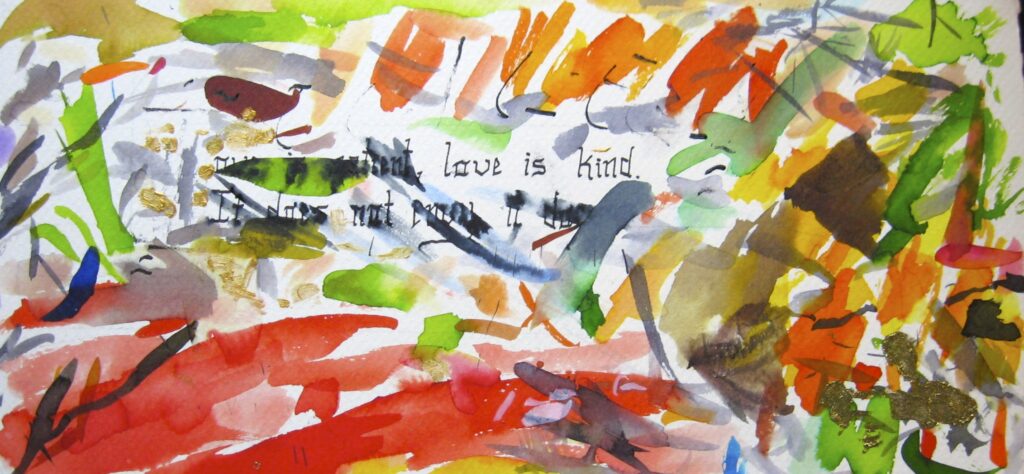
Love is Kind
watercolor, ink, brass suspension
always